New Haven night lights from space
Night Light of New Haven (Indiana) from space (United States) Src. Average luminocity for 10x10km area is 51.0503% and for 50x50km: 19.9252%.
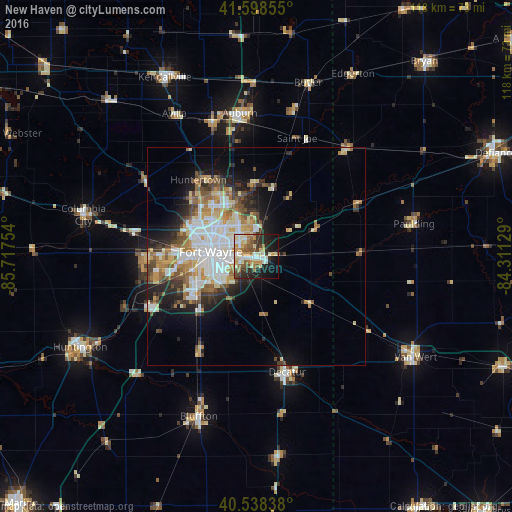
Analysis of New Haven night lights 2016
Square area 10x10 km:
 6.49%
6.49%90-99
11.04%80-89
10.39%70-79
7.79%60-69
6.82%50-59
7.47%40-49
5.68%30-39
5.68%20-29
13.15%10-19
19.81%0-9
5.68%Square area 50x50 km:
4.39%90-99
4.14%80-89
2.6%70-79
2.29%60-69
2.62%50-59
2.48%40-49
2.19%30-39
2.27%20-29
4.15%10-19
6.82%0-9
66.04%Clear (daylight) street map image can be seen on geolist.org.
Map coordinates:
41° 35' 54.8" North, 85° 43' 3.1" West
41° 4' 14.2" North, 85° 0' 51.9" West
40° 32' 18.2" North, 84° 18' 40.6" West
Some cities around New Haven sort by population:
• Fort Wayne
11.7 km =7.3 mi,  304°
304°
• Auburn
33.2 km =20.6 mi,  353°
353°
• Van Wert
42.5 km =26.4 mi,  121°
121°
• Bluffton
39.2 km =24.4 mi,  199°
199°
• Decatur
27.6 km =17.1 mi,  164°
164°
• Columbia City
40.9 km =25.4 mi,  283°
283°
• Garrett
32.6 km =20.3 mi,  341°
341°
• Huntertown
22 km =13.7 mi,  322°
322°
4924104 (p: 15,709)
Sources (retrieved 2019-11-25):
» Earth at Night: Flat Maps 2012, 2016