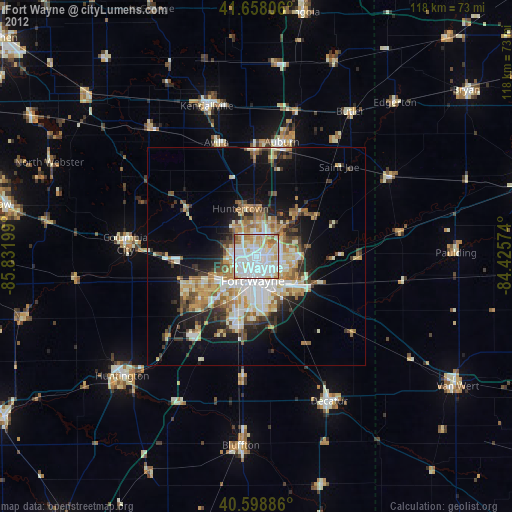
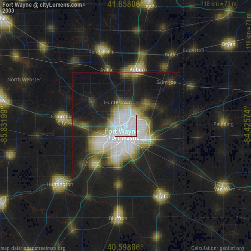
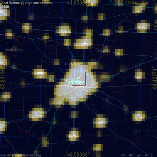
Fort Wayne night lights from space
Night Light of Fort Wayne (Indiana) from space (United States) Src. Average luminocity for 10x10km area is 91.487% and for 50x50km: 21.4579%.
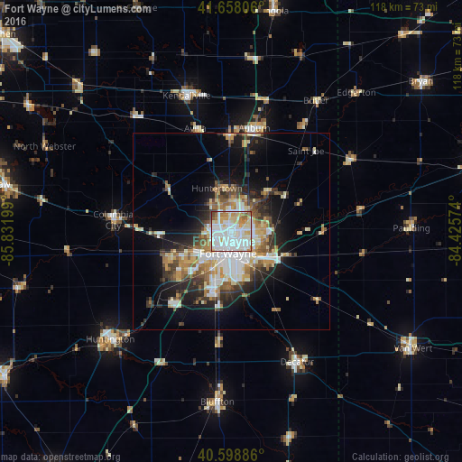
Analysis of Fort Wayne night lights 2016
Square area 10x10 km:
 38.64%
90-99
32.95%80-89
9.74%70-79
8.77%60-69
6.98%50-59
1.62%40-49
1.3%30-39
0%20-29
0%10-19
0%0-9
0%Square area 50x50 km:
4.46%90-99
4.35%80-89
2.69%70-79
2.54%60-69
2.69%50-59
2.67%40-49
2.3%30-39
2.58%20-29
4.76%10-19
8.78%0-9
62.17%Clear (daylight) street map image can be seen on geolist.org.
Map coordinates:
41° 39' 29" North, 85° 49' 55.2" West
41° 7' 50.2" North, 85° 7' 43.9" West
40° 35' 55.9" North, 84° 25' 32.7" West
Some cities around Fort Wayne sort by population:
• Huntington
41.4 km =25.7 mi,  228°
228°
• New Haven
11.7 km =7.3 mi,  124°
124°
• Auburn
26.9 km =16.7 mi,  12°
12°
• Kendallville
36.4 km =22.6 mi,  341°
341°
• Decatur
37.3 km =23.2 mi,  153°
153°
• Columbia City
30.2 km =18.8 mi,  275°
275°
• Garrett
24.3 km =15.1 mi,  358°
358°
• Huntertown
11.5 km =7.1 mi, 341°
4920423 (p: 260,326)
Sources (retrieved 2019-11-25):
» NASA, Earths city lights 1995
» NASA city lights 2003
» Earth at Night: Flat Maps 2012, 2016