New Albany night lights from space
Night Light of New Albany (Mississippi) from space (United States) Src. Average luminocity for 10x10km area is 35.1853% and for 50x50km: 6.5227%.
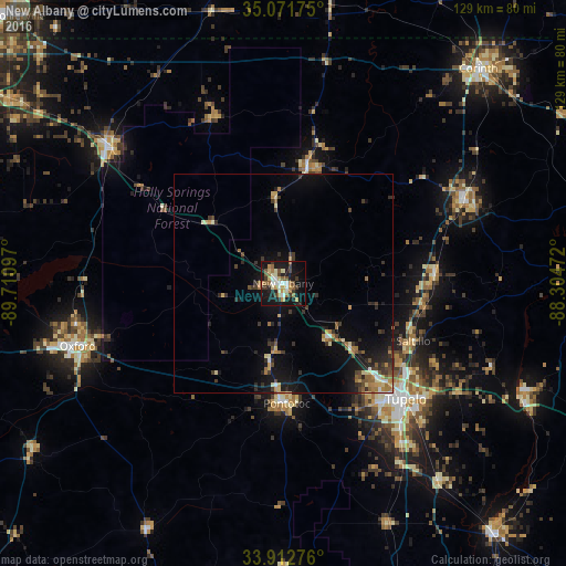
Analysis of New Albany night lights 2016
Square area 10x10 km:
 2.97%
2.97%90-99
7.52%80-89
3.85%70-79
5.24%60-69
4.2%50-59
6.64%40-49
3.67%30-39
6.82%20-29
4.9%10-19
38.99%0-9
15.21%Square area 50x50 km:
0.34%90-99
0.72%80-89
0.81%70-79
0.76%60-69
1.02%50-59
0.95%40-49
0.8%30-39
1.77%20-29
1.44%10-19
5.97%0-9
85.4%Clear (daylight) street map image can be seen on geolist.org.
Map coordinates:
35° 4' 18.3" North, 89° 42' 39.5" West
34° 29' 39.4" North, 89° 0' 28.2" West
33° 54' 45.9" North, 88° 18' 17" West
Some cities around New Albany sort by population:
• Tupelo
38.3 km =23.8 mi,  133°
133°
• Oxford
49 km =30.4 mi,  253°
253°
• Corinth
66.1 km =41.1 mi,  42°
42°
• Booneville
44.3 km =27.5 mi,  65°
65°
• Holly Springs
50.5 km =31.4 mi,  306°
306°
• Pontotoc
27.4 km =17 mi,  178°
178°
• Ripley
26.7 km =16.6 mi,  11°
11°
• Saltillo
32.6 km =20.3 mi,  113°
113°
4438121 (p: 8,830)
Sources (retrieved 2019-11-25):
» Earth at Night: Flat Maps 2012, 2016