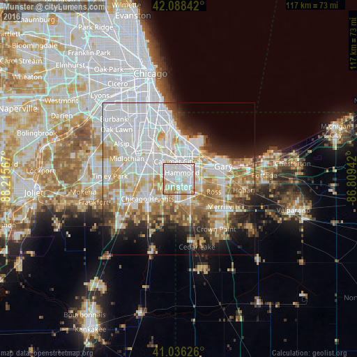
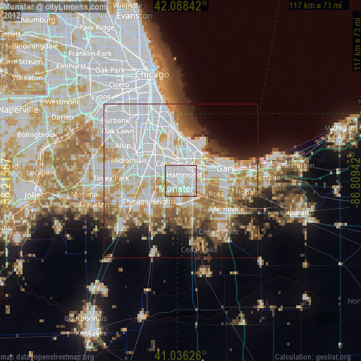
Munster night lights from space
Night Light of Munster (Indiana) from space (United States) Src. Average luminocity for 10x10km area is 95.4898% and for 50x50km: 59.5945%.
Analysis of Munster night lights 2016
Square area 10x10 km:
 57.65%
90-99
25%80-89
7.65%70-79
7.31%60-69
2.38%50-59
0%40-49
0%30-39
0%20-29
0%10-19
0%0-9
0%Square area 50x50 km:
22.9%90-99
12.97%80-89
6.57%70-79
7.13%60-69
7.33%50-59
4.99%40-49
3.54%30-39
3.87%20-29
5.29%10-19
7.63%0-9
17.79%Clear (daylight) street map image can be seen on geolist.org.
Map coordinates:
42° 5' 18.3" North, 88° 12' 56.4" West
41° 33' 52.1" North, 87° 30' 45.1" West
41° 2' 10.5" North, 86° 48' 33.9" West
Some cities around Munster sort by population:
• Hammond
2.3 km =1.4 mi,  26°
26°
• Calumet City
5.9 km =3.7 mi,  346°
346°
• Lansing
2.2 km =1.4 mi,  270°
270°
• Highland
5.2 km =3.2 mi,  103°
103°
• Griffith
8.4 km =5.2 mi,  118°
118°
• Dyer
7.9 km =4.9 mi,  185°
185°
• Lynwood
4.8 km =3 mi,  207°
207°
• Glenwood
7.9 km =4.9 mi,  251°
251°
4924014 (p: 22,984)
Sources (retrieved 2019-11-25):
» Earth at Night: Flat Maps 2012, 2016