Calumet City night lights from space
Night Light of Calumet City (Illinois) from space (United States) Src. Average luminocity for 10x10km area is 98.4432% and for 50x50km: 64.4623%.
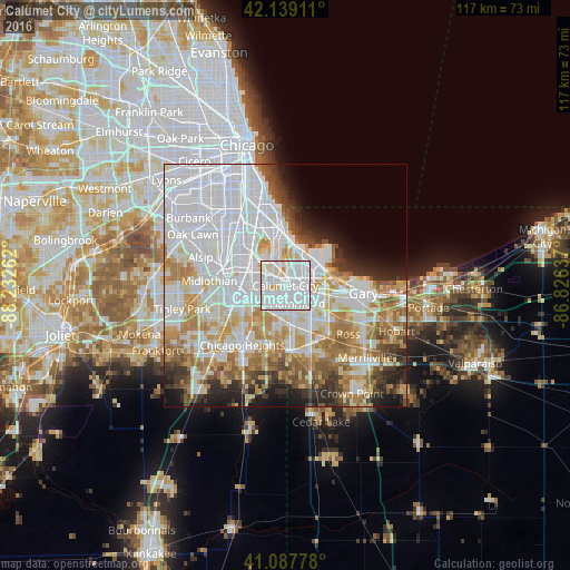
Analysis of Calumet City night lights 2016
Square area 10x10 km:
 67.05%
90-99
27.11%80-89
4.71%70-79
1.14%60-69
0%50-59
0%40-49
0%30-39
0%20-29
0%10-19
0%0-9
0%Square area 50x50 km:
27.56%90-99
14.13%80-89
6.49%70-79
7.2%60-69
7.3%50-59
4.78%40-49
3.49%30-39
3.87%20-29
4.7%10-19
5.21%0-9
15.26%Clear (daylight) street map image can be seen on geolist.org.
Map coordinates:
42° 8' 20.8" North, 88° 13' 57.4" West
41° 36' 56.1" North, 87° 31' 46.2" West
41° 5' 16" North, 86° 49' 34.9" West
Some cities around Calumet City sort by population:
• Hammond
4.3 km =2.7 mi,  145°
145°
• East Chicago
6.7 km =4.2 mi,  67°
67°
• Lansing
5.7 km =3.5 mi,  187°
187°
• Dolton
7 km =4.3 mi,  291°
291°
• Munster
5.9 km =3.7 mi,  166°
166°
• Highland
9.4 km =5.8 mi,  136°
136°
• South Holland
6.6 km =4.1 mi,  255°
255°
• Riverdale
8.8 km =5.5 mi,  282°
282°
4886255 (p: 37,031)
Sources (retrieved 2019-11-25):
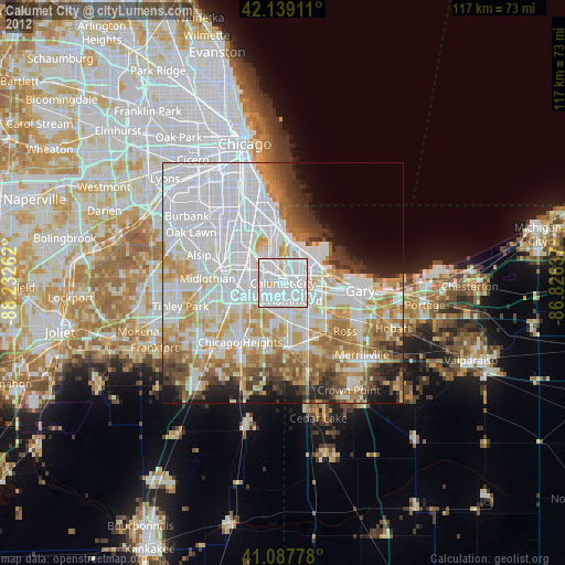
» Earth at Night: Flat Maps 2012, 2016