Hammond night lights from space
Night Light of Hammond (Indiana) from space (United States) Src. Average luminocity for 10x10km area is 97.9026% and for 50x50km: 60.5377%.
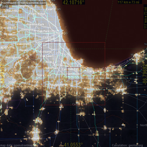
Analysis of Hammond night lights 2016
Square area 10x10 km:
 62.82%
90-99
29.22%80-89
6.01%70-79
1.95%60-69
0%50-59
0%40-49
0%30-39
0%20-29
0%10-19
0%0-9
0%Square area 50x50 km:
24.14%90-99
12.84%80-89
6.48%70-79
7.03%60-69
7.32%50-59
5.07%40-49
3.68%30-39
4.03%20-29
5.18%10-19
7.29%0-9
16.92%Clear (daylight) street map image can be seen on geolist.org.
Map coordinates:
42° 6' 25.8" North, 88° 12' 11.4" West
41° 35' 0.1" North, 87° 30' 0.1" West
41° 3' 19.1" North, 86° 47' 48.9" West
Some cities around Hammond sort by population:
• Calumet City
4.3 km =2.7 mi,  325°
325°
• East Chicago
7.3 km =4.5 mi,  31°
31°
• Lansing
3.8 km =2.4 mi,  237°
237°
• Munster
2.3 km =1.4 mi,  206°
206°
• Highland
5.2 km =3.2 mi,  129°
129°
• South Holland
9.1 km =5.7 mi,  282°
282°
• Griffith
8.8 km =5.5 mi, 133°
• Lynwood
7.1 km =4.4 mi, 206°
4921100 (p: 77,614)
Sources (retrieved 2019-11-25):
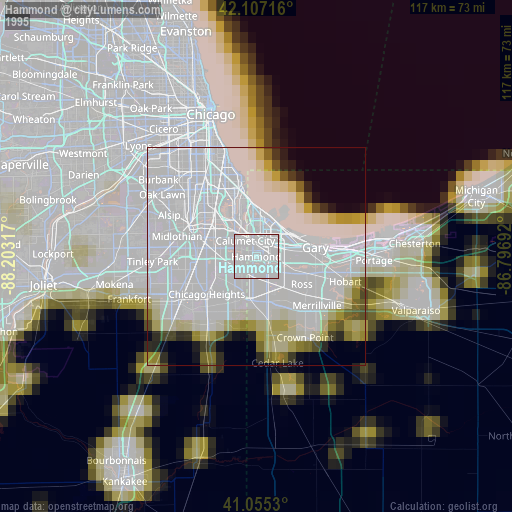
» NASA, Earths city lights 1995
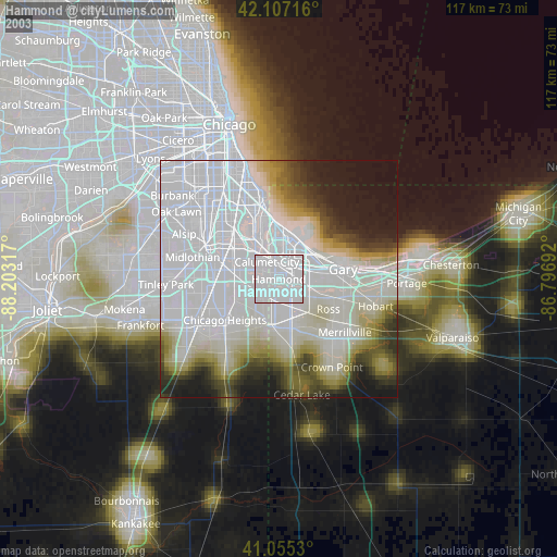
» NASA city lights 2003
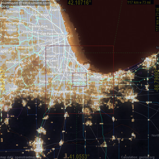
» Earth at Night: Flat Maps 2012, 2016