Camano night lights from space
Night Light of Camano (Washington) from space (United States) Src. Average luminocity for 10x10km area is 0.1488% and for 50x50km: 3.7938%.
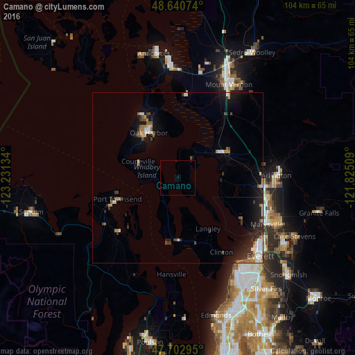
Analysis of Camano night lights 2016
Square area 10x10 km:
 0%
0%90-99
0%80-89
0%70-79
0%60-69
0%50-59
0%40-49
0%30-39
0%20-29
0%10-19
0.6%0-9
99.4%Square area 50x50 km:
0.51%90-99
0.52%80-89
0.31%70-79
0.27%60-69
0.46%50-59
0.47%40-49
0.47%30-39
0.67%20-29
1.49%10-19
3.2%0-9
91.62%Clear (daylight) street map image can be seen on geolist.org.
Map coordinates:
48° 38' 26.7" North, 123° 13' 52.8" West
48° 10' 26.4" North, 122° 31' 41.6" West
47° 42' 10.6" North, 121° 49' 30.3" West
Some cities around Camano sort by population:
• Marysville
29.4 km =18.3 mi,  117°
117°
• Mount Vernon
31 km =19.3 mi,  27°
27°
• Oak Harbor
15.8 km =9.8 mi,  327°
327°
• Mukilteo
30.4 km =18.9 mi,  146°
146°
• Arlington
30 km =18.6 mi,  84°
84°
• Port Townsend
18.4 km =11.4 mi,  249°
249°
• Tulalip
21.1 km =13.1 mi, 123°
• Stanwood
13.9 km =8.6 mi,  57°
57°
5788816 (p: 14,202)
Sources (retrieved 2019-11-25):
» Earth at Night: Flat Maps 2012, 2016