Mount Airy night lights from space
Night Light of Mount Airy (North Carolina) from space (United States) Src. Average luminocity for 10x10km area is 49.7308% and for 50x50km: 5.6408%.
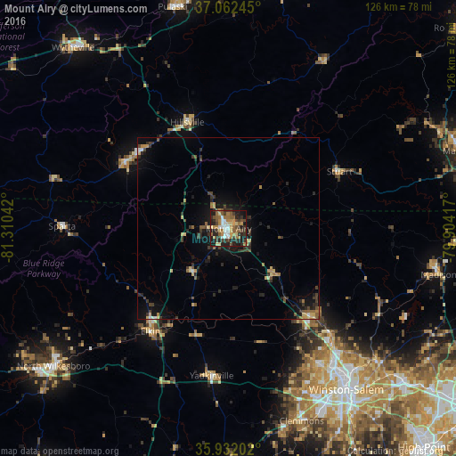
Analysis of Mount Airy night lights 2016
Square area 10x10 km:
 5.68%
5.68%90-99
6.23%80-89
6.96%70-79
8.42%60-69
12.09%50-59
8.79%40-49
6.96%30-39
12.64%20-29
13.74%10-19
17.95%0-9
0.55%Square area 50x50 km:
0.29%90-99
0.34%80-89
0.8%70-79
0.75%60-69
0.88%50-59
0.85%40-49
0.9%30-39
1.59%20-29
1.59%10-19
4.41%0-9
87.6%Clear (daylight) street map image can be seen on geolist.org.
Map coordinates:
37° 3' 44.8" North, 81° 18' 37.5" West
36° 29' 57.5" North, 80° 36' 26.2" West
35° 55' 55.3" North, 79° 54' 15" West
Some cities around Mount Airy sort by population:
• Winston-Salem
55.1 km =34.2 mi,  143°
143°
• Kernersville
63.8 km =39.6 mi,  131°
131°
• Clemmons
56.8 km =35.3 mi,  159°
159°
• Lewisville
47.8 km =29.7 mi, 159°
• Pulaski
62.9 km =39.1 mi,  345°
345°
• King
32.9 km =20.4 mi, 137°
• Galax
33.5 km =20.8 mi,  302°
302°
• Stokesdale
63.3 km =39.3 mi,  117°
117°
4480378 (p: 10,354)
Sources (retrieved 2019-11-25):
» Earth at Night: Flat Maps 2012, 2016