Morris Park night lights from space
Night Light of Morris Park (New York) from space (United States) Src. Average luminocity for 10x10km area is 94.585% and for 50x50km: 81.9045%.
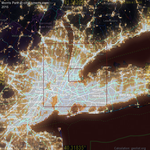
Analysis of Morris Park night lights 2016
Square area 10x10 km:
 61.05%
90-99
22.28%80-89
2.72%70-79
6.46%60-69
6.12%50-59
1.36%40-49
0%30-39
0%20-29
0%10-19
0%0-9
0%Square area 50x50 km:
41.5%90-99
17.16%80-89
6.2%70-79
8.42%60-69
10.19%50-59
4.67%40-49
2.7%30-39
2.28%20-29
2.4%10-19
3.09%0-9
1.4%Clear (daylight) street map image can be seen on geolist.org.
Map coordinates:
41° 22' 55.3" North, 74° 33' 23.8" West
40° 51' 8.4" North, 73° 51' 12.5" West
40° 19' 6.1" North, 73° 9' 1.3" West
Some cities around Morris Park sort by population:
• The Bronx
1.1 km =0.7 mi,  255°
255°
• Fordham
3.9 km =2.4 mi,  281°
281°
• Parkchester
1.6 km =1 mi,  201°
201°
• Throgs Neck
4.4 km =2.7 mi,  139°
139°
• Unionport
2.8 km =1.7 mi,  174°
174°
• Van Nest
1 km =0.6 mi,  243°
243°
• East Tremont
3.2 km =2 mi, 256°
• Baychester
2.4 km =1.5 mi,  37°
37°
5127542 (p: 10,289)
Sources (retrieved 2019-11-25):
» Earth at Night: Flat Maps 2012, 2016