Fordham night lights from space
Night Light of Fordham (New York) from space (United States) Src. Average luminocity for 10x10km area is 96.7415% and for 50x50km: 83.7153%.
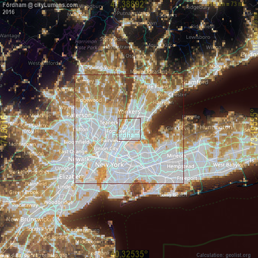
Analysis of Fordham night lights 2016
Square area 10x10 km:
 67.86%
90-99
21.6%80-89
1.7%70-79
6.46%60-69
2.38%50-59
0%40-49
0%30-39
0%20-29
0%10-19
0%0-9
0%Square area 50x50 km:
42.94%90-99
17.79%80-89
6.43%70-79
8.46%60-69
10.41%50-59
4.24%40-49
2.3%30-39
2.22%20-29
2.17%10-19
2.51%0-9
0.51%Clear (daylight) street map image can be seen on geolist.org.
Map coordinates:
41° 23' 20.1" North, 74° 36' 5.8" West
40° 51' 33.4" North, 73° 53' 54.5" West
40° 19' 31.3" North, 73° 11' 43.3" West
Some cities around Fordham sort by population:
• The Bronx
2.9 km =1.8 mi,  111°
111°
• Kings Bridge
2.2 km =1.4 mi,  345°
345°
• Morris Heights
2.1 km =1.3 mi,  239°
239°
• University Heights
0.9 km =0.6 mi,  275°
275°
• East Tremont
1.7 km =1.1 mi,  157°
157°
• Tremont
1.2 km =0.7 mi,  209°
209°
• Spuyten Duyvil
2.9 km =1.8 mi,  326°
326°
• Inwood
2.5 km =1.6 mi,  286°
286°
5117549 (p: 94,678)
Sources (retrieved 2019-11-25):
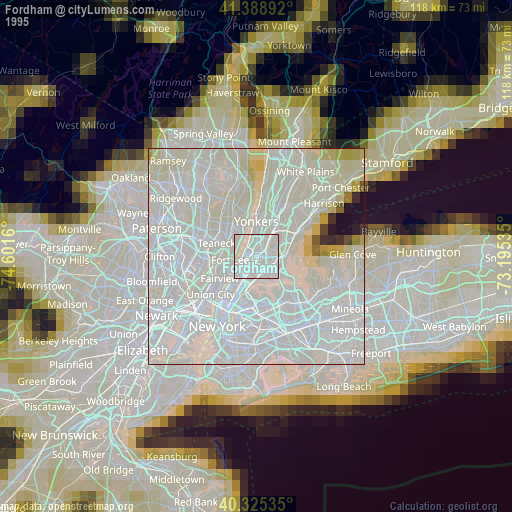
» NASA, Earths city lights 1995
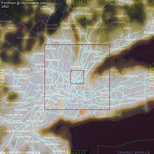
» NASA city lights 2003
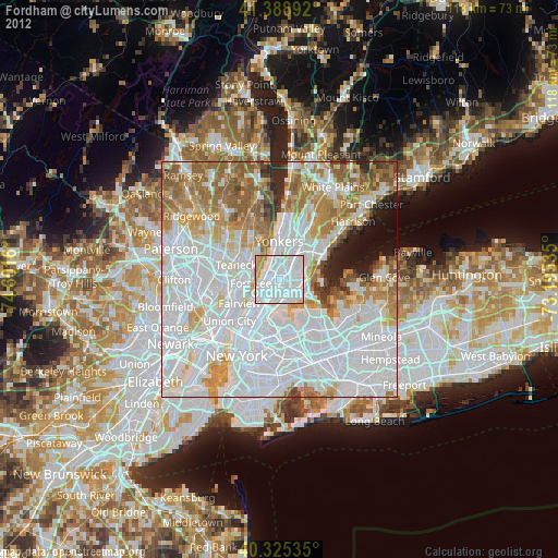
» Earth at Night: Flat Maps 2012, 2016