Morehead night lights from space
Night Light of Morehead (Kentucky) from space (United States) Src. Average luminocity for 10x10km area is 24.2585% and for 50x50km: 2.1473%.
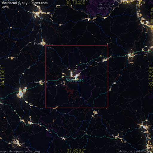
Analysis of Morehead night lights 2016
Square area 10x10 km:
 3.06%
3.06%90-99
5.1%80-89
2.04%70-79
3.4%60-69
2.21%50-59
3.57%40-49
2.72%30-39
3.57%20-29
3.06%10-19
25%0-9
46.26%Square area 50x50 km:
0.14%90-99
0.28%80-89
0.2%70-79
0.28%60-69
0.16%50-59
0.28%40-49
0.35%30-39
0.58%20-29
0.59%10-19
1.46%0-9
95.69%Clear (daylight) street map image can be seen on geolist.org.
Map coordinates:
38° 44' 4.4" North, 84° 8' 8.9" West
38° 11' 2.3" North, 83° 25' 57.6" West
37° 37' 45.1" North, 82° 43' 46.4" West
Some cities around Morehead sort by population:
• Ironville
71.3 km =44.3 mi,  64°
64°
• Meads
68.1 km =42.3 mi,  68°
68°
• Portsmouth
71.7 km =44.6 mi,  31°
31°
• Winchester
68.8 km =42.8 mi,  251°
251°
• Paris
71.7 km =44.6 mi,  272°
272°
• Maysville
57.6 km =35.8 mi,  331°
331°
• Flatwoods
72.9 km =45.3 mi, 58°
• Mount Sterling
46.9 km =29.1 mi, 252°
4301307 (p: 7,045)
Sources (retrieved 2019-11-25):
» Earth at Night: Flat Maps 2012, 2016