Montrose-Ghent night lights from space
Night Light of Montrose-Ghent (Ohio) from space (United States) Src. Average luminocity for 10x10km area is 50.6364% and for 50x50km: 50.9763%.
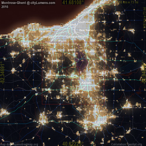
Analysis of Montrose-Ghent night lights 2016
Square area 10x10 km:
 5.52%
5.52%90-99
5.03%80-89
5.52%70-79
7.95%60-69
12.5%50-59
10.06%40-49
11.36%30-39
14.61%20-29
20.29%10-19
7.14%0-9
0%Square area 50x50 km:
7.13%90-99
8.47%80-89
4.72%70-79
6.76%60-69
12.25%50-59
12.06%40-49
9.63%30-39
8.33%20-29
11.77%10-19
13.07%0-9
5.81%Clear (daylight) street map image can be seen on geolist.org.
Map coordinates:
41° 40' 51.9" North, 82° 20' 48.9" West
41° 9' 13.7" North, 81° 38' 37.6" West
40° 37' 20.1" North, 80° 56' 26.4" West
Some cities around Montrose-Ghent sort by population:
• Akron
13.2 km =8.2 mi,  127°
127°
• Cuyahoga Falls
13.5 km =8.4 mi,  99°
99°
• Stow
17 km =10.6 mi,  87°
87°
• Barberton
16 km =9.9 mi,  168°
168°
• Wadsworth
16 km =9.9 mi,  206°
206°
• Copley
6.1 km =3.8 mi,  180°
180°
• Norton
13.9 km =8.6 mi, 178°
• Fairlawn
4.1 km =2.5 mi,  135°
135°
7259400 (p: 5,177)
Sources (retrieved 2019-11-25):
» Earth at Night: Flat Maps 2012, 2016