Akron night lights from space
Night Light of Akron (Ohio) from space (United States) Src. Average luminocity for 10x10km area is 96.9627% and for 50x50km: 43.617%.
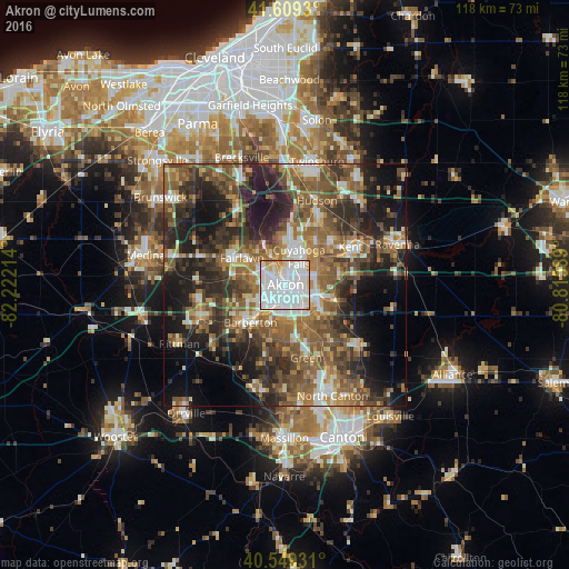
Analysis of Akron night lights 2016
Square area 10x10 km:
 48.54%
90-99
40.58%80-89
5.52%70-79
4.06%60-69
1.3%50-59
0%40-49
0%30-39
0%20-29
0%10-19
0%0-9
0%Square area 50x50 km:
5.79%90-99
6.88%80-89
3.75%70-79
5.02%60-69
8.96%50-59
10.39%40-49
9.57%30-39
8.19%20-29
12.56%10-19
14.85%0-9
14.05%Clear (daylight) street map image can be seen on geolist.org.
Map coordinates:
41° 36' 33.5" North, 82° 13' 19.7" West
41° 4' 53.2" North, 81° 31' 8.4" West
40° 32' 57.5" North, 80° 48' 57.2" West
Some cities around Akron sort by population:
• Cuyahoga Falls
6.5 km =4 mi,  26°
26°
• Stow
10.9 km =6.8 mi,  37°
37°
• Barberton
10.5 km =6.5 mi,  223°
223°
• Tallmadge
6.8 km =4.2 mi,  71°
71°
• Copley
10.7 km =6.6 mi,  280°
280°
• Fairlawn
9.2 km =5.7 mi,  304°
304°
• Portage Lakes
8.3 km =5.2 mi,  184°
184°
• Munroe Falls
9.7 km =6 mi, 43°
5145476 (p: 197,542)
Sources (retrieved 2019-11-25):
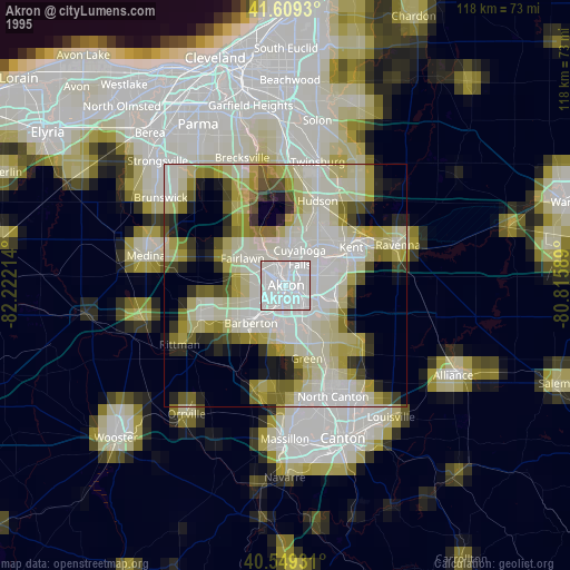
» NASA, Earths city lights 1995
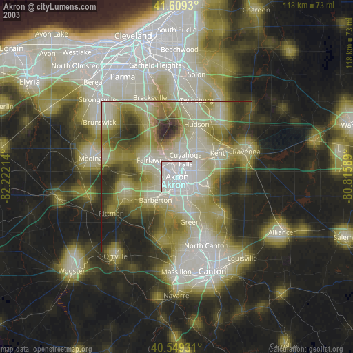
» NASA city lights 2003
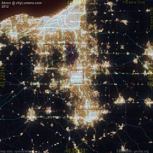
» Earth at Night: Flat Maps 2012, 2016