Fairlawn night lights from space
Night Light of Fairlawn (Ohio) from space (United States) Src. Average luminocity for 10x10km area is 67.7451% and for 50x50km: 49.1318%.
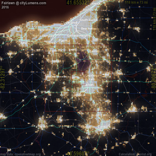
Analysis of Fairlawn night lights 2016
Square area 10x10 km:
 14.77%
90-99
11.2%80-89
6.49%70-79
11.2%60-69
17.53%50-59
14.12%40-49
11.53%30-39
7.79%20-29
5.36%10-19
0%0-9
0%Square area 50x50 km:
6.58%90-99
8.05%80-89
4.28%70-79
6.24%60-69
11.33%50-59
11.9%40-49
10.15%30-39
8.7%20-29
12.53%10-19
12.96%0-9
7.29%Clear (daylight) street map image can be seen on geolist.org.
Map coordinates:
41° 39' 19.2" North, 82° 18' 46.7" West
41° 7' 40.2" North, 81° 36' 35.4" West
40° 35' 45.9" North, 80° 54' 24.2" West
Some cities around Fairlawn sort by population:
• Akron
9.2 km =5.7 mi,  124°
124°
• Cuyahoga Falls
10.5 km =6.5 mi,  86°
86°
• Barberton
12.8 km =8 mi,  178°
178°
• Tallmadge
14.4 km =8.9 mi,  101°
101°
• Copley
4.3 km =2.7 mi,  222°
222°
• Norton
11.2 km =7 mi,  192°
192°
• Montrose-Ghent
4.1 km =2.5 mi,  315°
315°
• Munroe Falls
14.4 km =8.9 mi,  82°
82°
5153592 (p: 7,413)
Sources (retrieved 2019-11-25):
» Earth at Night: Flat Maps 2012, 2016