Cuyahoga Falls night lights from space
Night Light of Cuyahoga Falls (Ohio) from space (United States) Src. Average luminocity for 10x10km area is 83.1234% and for 50x50km: 44.2024%.

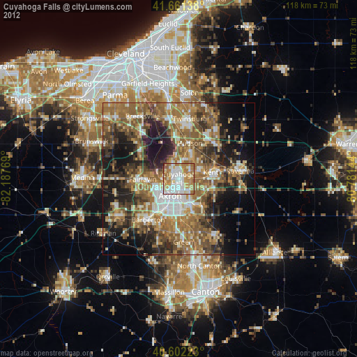
Analysis of Cuyahoga Falls night lights 2016
Square area 10x10 km:
 24.03%
90-99
24.51%80-89
7.31%70-79
12.99%60-69
24.03%50-59
6.17%40-49
0.65%30-39
0.32%20-29
0%10-19
0%0-9
0%Square area 50x50 km:
5.74%90-99
6.98%80-89
3.95%70-79
5.43%60-69
10.01%50-59
10.6%40-49
9.17%30-39
7.93%20-29
11.46%10-19
13.25%0-9
15.48%Clear (daylight) street map image can be seen on geolist.org.
Map coordinates:
41° 39' 41" North, 82° 11' 15.7" West
41° 8' 2.2" North, 81° 29' 4.4" West
40° 36' 8" North, 80° 46' 53.2" West
Some cities around Cuyahoga Falls sort by population:
• Akron
6.5 km =4 mi,  206°
206°
• Stow
4.7 km =2.9 mi,  52°
52°
• Kent
10.8 km =6.7 mi,  78°
78°
• Hudson
12.4 km =7.7 mi,  17°
17°
• Tallmadge
5.1 km =3.2 mi,  135°
135°
• Fairlawn
10.5 km =6.5 mi,  266°
266°
• Montrose-Ghent
13.5 km =8.4 mi,  279°
279°
• Munroe Falls
3.9 km =2.4 mi,  72°
72°
5151613 (p: 49,146)
Sources (retrieved 2019-11-25):
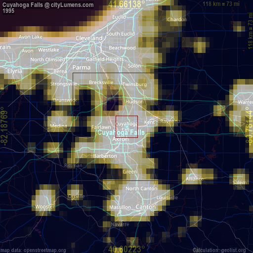
» NASA, Earths city lights 1995
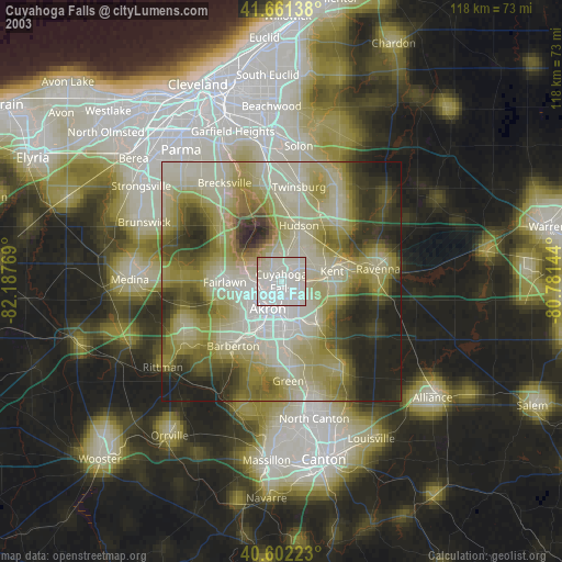
» NASA city lights 2003
» Earth at Night: Flat Maps 2012, 2016