Norton night lights from space
Night Light of Norton (Ohio) from space (United States) Src. Average luminocity for 10x10km area is 57.3248% and for 50x50km: 44.2784%.
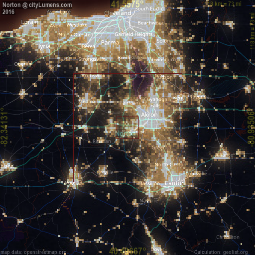
Analysis of Norton night lights 2016
Square area 10x10 km:
 5.44%
5.44%90-99
10.88%80-89
8.33%70-79
5.27%60-69
11.39%50-59
11.9%40-49
15.65%30-39
18.37%20-29
12.76%10-19
0%0-9
0%Square area 50x50 km:
6.52%90-99
7.71%80-89
3.7%70-79
5.34%60-69
9.39%50-59
9.45%40-49
8.26%30-39
7.58%20-29
11.67%10-19
15.86%0-9
14.53%Clear (daylight) street map image can be seen on geolist.org.
Map coordinates:
41° 33' 27" North, 82° 20' 28.7" West
41° 1' 45.2" North, 81° 38' 17.4" West
40° 29' 48" North, 80° 56' 6.2" West
Some cities around Norton sort by population:
• Akron
11.6 km =7.2 mi,  59°
59°
• Barberton
3.3 km =2.1 mi,  123°
123°
• Wadsworth
7.7 km =4.8 mi,  267°
267°
• New Franklin
12.7 km =7.9 mi,  140°
140°
• Copley
7.8 km =4.8 mi,  356°
356°
• Fairlawn
11.2 km =7 mi,  12°
12°
• Portage Lakes
9.6 km =6 mi,  104°
104°
• Rittman
13.3 km =8.3 mi,  244°
244°
5165087 (p: 12,036)
Sources (retrieved 2019-11-25):
» Earth at Night: Flat Maps 2012, 2016