Chelsea night lights from space
Night Light of Chelsea (Alabama) from space (United States) Src. Average luminocity for 10x10km area is 31.0787% and for 50x50km: 33.3733%.
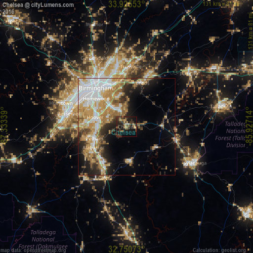
Analysis of Chelsea night lights 2016
Square area 10x10 km:
 1.22%
1.22%90-99
0.87%80-89
6.47%70-79
2.45%60-69
5.94%50-59
2.97%40-49
8.74%30-39
13.46%20-29
11.36%10-19
29.72%0-9
16.78%Square area 50x50 km:
7.5%90-99
5.37%80-89
4.49%70-79
6.25%60-69
6.18%50-59
3.16%40-49
3.24%30-39
3.91%20-29
5.8%10-19
8.9%0-9
45.19%Clear (daylight) street map image can be seen on geolist.org.
Map coordinates:
33° 55' 31.9" North, 87° 20' 0.2" West
33° 20' 24.4" North, 86° 37' 48.9" West
32° 45' 2.6" North, 85° 55' 37.7" West
Some cities around Chelsea sort by population:
• Hoover
18.3 km =11.4 mi,  293°
293°
• Vestavia Hills
19 km =11.8 mi,  309°
309°
• Alabaster
20.3 km =12.6 mi,  238°
238°
• Pelham
17.8 km =11.1 mi,  250°
250°
• Meadowbrook
9.2 km =5.7 mi,  318°
318°
• Lake Purdy
11 km =6.8 mi,  334°
334°
• Brook Highland
11.4 km =7.1 mi,  339°
339°
• Cahaba Heights
16.7 km =10.4 mi, 325°
4054852 (p: 12,059)
Sources (retrieved 2019-11-25):
» Earth at Night: Flat Maps 2012, 2016