Hoover night lights from space
Night Light of Hoover (Alabama) from space (United States) Src. Average luminocity for 10x10km area is 84.7028% and for 50x50km: 48.9318%.
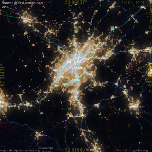
Analysis of Hoover night lights 2016
Square area 10x10 km:
 18.18%
90-99
23.08%80-89
14.86%70-79
32.87%60-69
10.84%50-59
0.17%40-49
0%30-39
0%20-29
0%10-19
0%0-9
0%Square area 50x50 km:
10.13%90-99
8.09%80-89
7.59%70-79
9.92%60-69
9.5%50-59
5.33%40-49
5.16%30-39
5.8%20-29
7.46%10-19
9.52%0-9
21.5%Clear (daylight) street map image can be seen on geolist.org.
Map coordinates:
33° 59' 25.3" North, 87° 30' 52.2" West
33° 24' 19.4" North, 86° 48' 41" West
32° 48' 59.2" North, 86° 6' 29.7" West
Some cities around Hoover sort by population:
• Vestavia Hills
5.3 km =3.3 mi,  24°
24°
• Homewood
7.4 km =4.6 mi,  7°
7°
• Mountain Brook
12 km =7.5 mi,  27°
27°
• Helena
12.5 km =7.8 mi,  193°
193°
• Meadowbrook
10.7 km =6.6 mi,  91°
91°
• Lake Purdy
12.5 km =7.8 mi,  77°
77°
• Cahaba Heights
9.8 km =6.1 mi,  48°
48°
• Midfield
11 km =6.8 mi,  304°
304°
4067994 (p: 84,848)
Sources (retrieved 2019-11-25):
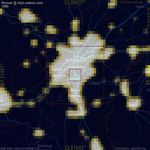
» NASA, Earths city lights 1995
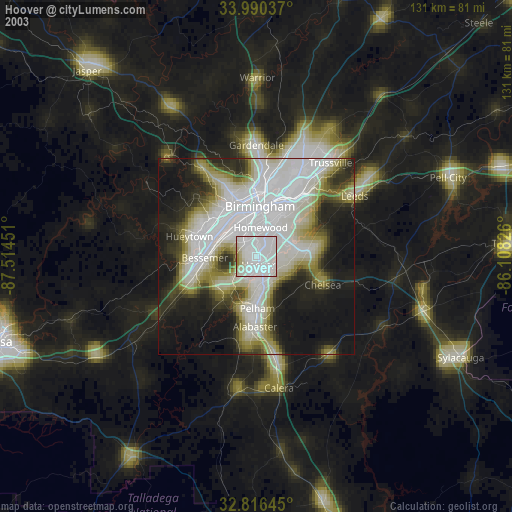
» NASA city lights 2003
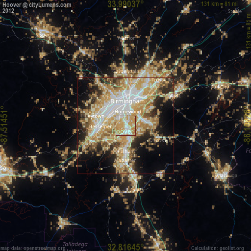
» Earth at Night: Flat Maps 2012, 2016