Montclair night lights from space
Night Light of Montclair (New Jersey) from space (United States) Src. Average luminocity for 10x10km area is 94.0017% and for 50x50km: 79.513%.
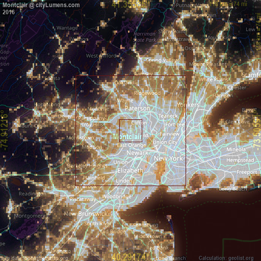
Analysis of Montclair night lights 2016
Square area 10x10 km:
 36.73%
90-99
35.71%80-89
19.22%70-79
8.33%60-69
0%50-59
0%40-49
0%30-39
0%20-29
0%10-19
0%0-9
0%Square area 50x50 km:
33.74%90-99
17.74%80-89
8.06%70-79
10.93%60-69
11.47%50-59
6.31%40-49
2.5%30-39
1.96%20-29
2.4%10-19
1.82%0-9
3.08%Clear (daylight) street map image can be seen on geolist.org.
Map coordinates:
41° 21' 21.1" North, 74° 54' 43.8" West
40° 49' 33.3" North, 74° 12' 32.5" West
40° 17' 30.3" North, 73° 30' 21.3" West
Some cities around Montclair sort by population:
• Bloomfield
2.9 km =1.8 mi,  136°
136°
• West Orange
3.9 km =2.4 mi,  219°
219°
• Nutley
4.2 km =2.6 mi,  95°
95°
• Verona
2.7 km =1.7 mi,  279°
279°
• Cedar Grove
3.3 km =2.1 mi,  329°
329°
• Upper Montclair
2.3 km =1.4 mi,  16°
16°
• Brookdale
2.4 km =1.5 mi,  68°
68°
• Glen Ridge
2.3 km =1.4 mi,  169°
169°
5101334 (p: 39,701)
Sources (retrieved 2019-11-25):
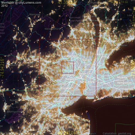
» Earth at Night: Flat Maps 2012, 2016