Mitchellville night lights from space
Night Light of Mitchellville (Maryland) from space (United States) Src. Average luminocity for 10x10km area is 70.7959% and for 50x50km: 59.7825%.
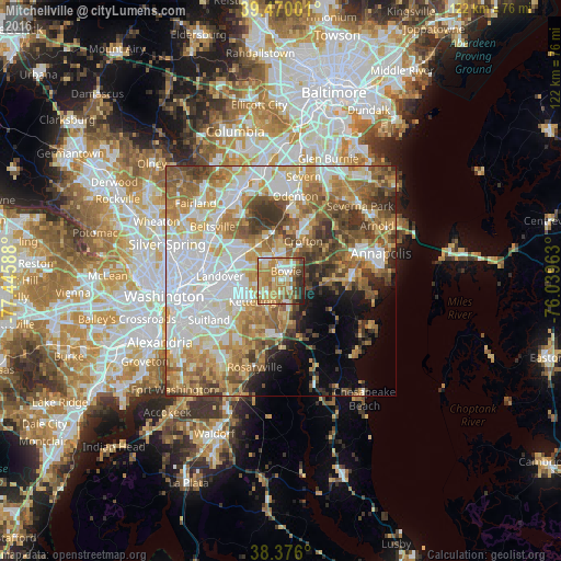
Analysis of Mitchellville night lights 2016
Square area 10x10 km:
 8.84%
8.84%90-99
13.61%80-89
10.54%70-79
27.21%60-69
16.33%50-59
5.61%40-49
6.12%30-39
5.61%20-29
5.95%10-19
0.17%0-9
0%Square area 50x50 km:
15.52%90-99
11.94%80-89
8.5%70-79
10.09%60-69
9.34%50-59
9.25%40-49
6.28%30-39
6.02%20-29
3.53%10-19
4.52%0-9
15%Clear (daylight) street map image can be seen on geolist.org.
Map coordinates:
39° 28' 12" North, 77° 26' 45.2" West
38° 55' 30.4" North, 76° 44' 33.9" West
38° 22' 33.6" North, 76° 2' 22.7" West
Some cities around Mitchellville sort by population:
• Bowie
2.2 km =1.4 mi,  28°
28°
• Crofton
9.8 km =6.1 mi, 29°
• Glenn Dale
9.7 km =6 mi,  315°
315°
• Kettering
7.7 km =4.8 mi,  234°
234°
• Largo
8.2 km =5.1 mi,  248°
248°
• Lake Arbor
7.8 km =4.8 mi,  255°
255°
• Brock Hall
8.5 km =5.3 mi,  190°
190°
• Fairwood
4.6 km =2.9 mi, 319°
4362624 (p: 10,967)
Sources (retrieved 2019-11-25):
» Earth at Night: Flat Maps 2012, 2016