Fairwood night lights from space
Night Light of Fairwood (Maryland) from space (United States) Src. Average luminocity for 10x10km area is 81.737% and for 50x50km: 65.9781%.
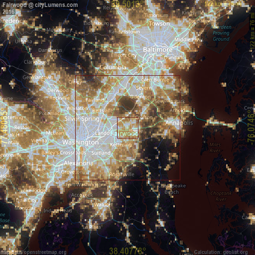
Analysis of Fairwood night lights 2016
Square area 10x10 km:
 11.04%
90-99
21.1%80-89
18.83%70-79
31.17%60-69
15.1%50-59
2.6%40-49
0.16%30-39
0%20-29
0%10-19
0%0-9
0%Square area 50x50 km:
18.58%90-99
14.68%80-89
9.31%70-79
10.52%60-69
9.69%50-59
9.23%40-49
5.72%30-39
5.44%20-29
3.25%10-19
3.81%0-9
9.77%Clear (daylight) street map image can be seen on geolist.org.
Map coordinates:
39° 30' 4.7" North, 77° 28' 51.1" West
38° 57' 23.9" North, 76° 46' 39.8" West
38° 24' 28" North, 76° 4' 28.6" West
Some cities around Fairwood sort by population:
• Bowie
4.4 km =2.7 mi,  110°
110°
• Lanham-Seabrook
6.5 km =4 mi,  281°
281°
• Seabrook
6.1 km =3.8 mi, 282°
• Glenn Dale
5.1 km =3.2 mi,  312°
312°
• Mitchellville
4.6 km =2.9 mi,  139°
139°
• Lanham
7.5 km =4.7 mi, 280°
• Lake Arbor
7 km =4.3 mi,  219°
219°
• Goddard
7.5 km =4.7 mi,  299°
299°
7315258 (p: 5,031)
Sources (retrieved 2019-11-25):
» Earth at Night: Flat Maps 2012, 2016