Midland night lights from space
Night Light of Midland (Texas) from space (United States) Src. Average luminocity for 10x10km area is 82.0052% and for 50x50km: 19.0941%.
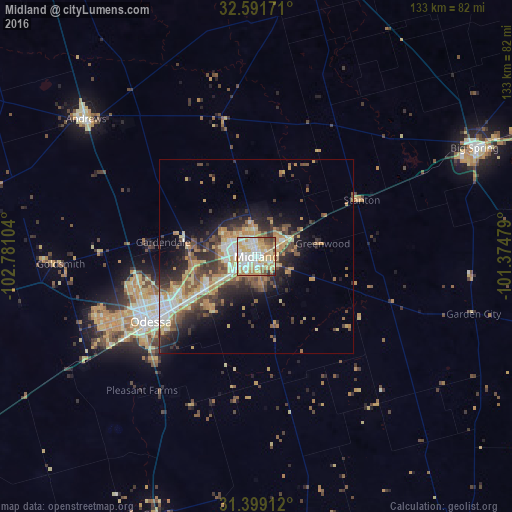
Analysis of Midland night lights 2016
Square area 10x10 km:
 18.71%
90-99
23.25%80-89
18.18%70-79
18.53%60-69
9.79%50-59
3.85%40-49
4.2%30-39
2.45%20-29
1.05%10-19
0%0-9
0%Square area 50x50 km:
2.28%90-99
2.76%80-89
2.99%70-79
3.71%60-69
2.72%50-59
2.53%40-49
3.54%30-39
3.01%20-29
5.05%10-19
7.2%0-9
64.21%Clear (daylight) street map image can be seen on geolist.org.
Map coordinates:
32° 35' 30.2" North, 102° 46' 51.7" West
31° 59' 50.5" North, 102° 4' 40.5" West
31° 23' 56.8" North, 101° 22' 29.2" West
Some cities around Midland sort by population:
• Odessa
32.1 km =19.9 mi,  238°
238°
• Big Spring
63 km =39.1 mi,  63°
63°
• West Odessa
43.3 km =26.9 mi,  246°
246°
• Andrews
56.7 km =35.2 mi,  309°
309°
• Lamesa
83.2 km =51.7 mi,  8°
8°
• Monahans
89.1 km =55.4 mi, 239°
• Seminole
96.3 km =59.8 mi,  326°
326°
• Kermit
97 km =60.3 mi,  260°
260°
5526337 (p: 132,950)
Sources (retrieved 2019-11-25):
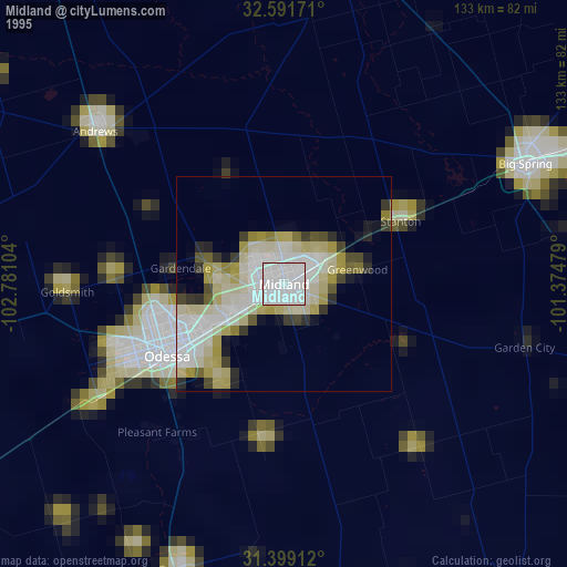
» NASA, Earths city lights 1995
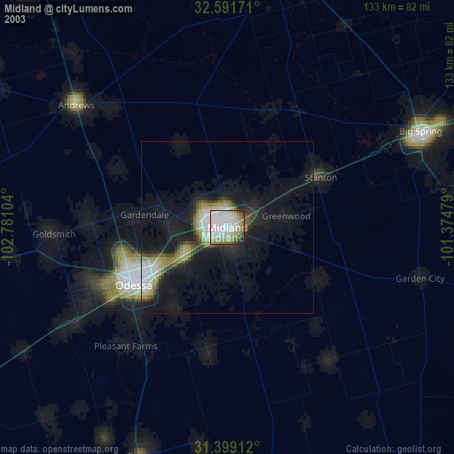
» NASA city lights 2003
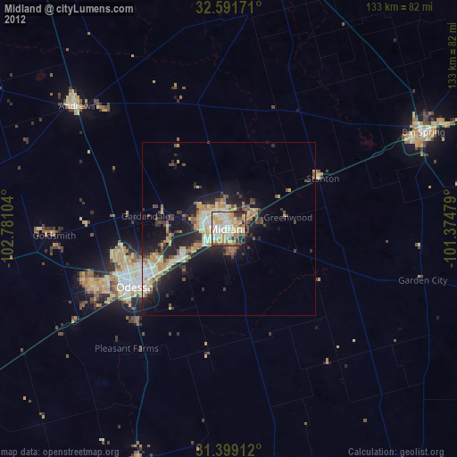
» Earth at Night: Flat Maps 2012, 2016