Homewood night lights from space
Night Light of Homewood (Alabama) from space (United States) Src. Average luminocity for 10x10km area is 92.8724% and for 50x50km: 52.4926%.
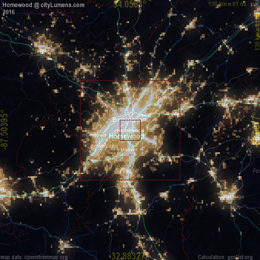
Analysis of Homewood night lights 2016
Square area 10x10 km:
 43.53%
90-99
28.5%80-89
9.27%70-79
17.66%60-69
1.05%50-59
0%40-49
0%30-39
0%20-29
0%10-19
0%0-9
0%Square area 50x50 km:
10.5%90-99
8.58%80-89
8.19%70-79
10.53%60-69
10.38%50-59
5.91%40-49
5.88%30-39
6.69%20-29
8.68%10-19
9.64%0-9
15.02%Clear (daylight) street map image can be seen on geolist.org.
Map coordinates:
34° 3' 22.7" North, 87° 30' 14.2" West
33° 28' 18.4" North, 86° 48' 3" West
32° 52' 59.8" North, 86° 5' 51.7" West
Some cities around Homewood sort by population:
• Birmingham
5.4 km =3.4 mi,  358°
358°
• Hoover
7.4 km =4.6 mi,  187°
187°
• Vestavia Hills
2.8 km =1.7 mi,  154°
154°
• Mountain Brook
5.6 km =3.5 mi,  54°
54°
• Irondale
11.4 km =7.1 mi, 49°
• Fairfield
10.4 km =6.5 mi,  278°
278°
• Cahaba Heights
6.4 km =4 mi,  97°
97°
• Midfield
10.1 km =6.3 mi,  263°
263°
4067927 (p: 25,708)
Sources (retrieved 2019-11-25):
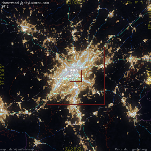
» Earth at Night: Flat Maps 2012, 2016