Miami Beach night lights from space
Night Light of Miami Beach (Florida) from space (United States) Src. Average luminocity for 10x10km area is 59.7727% and for 50x50km: 42.584%.
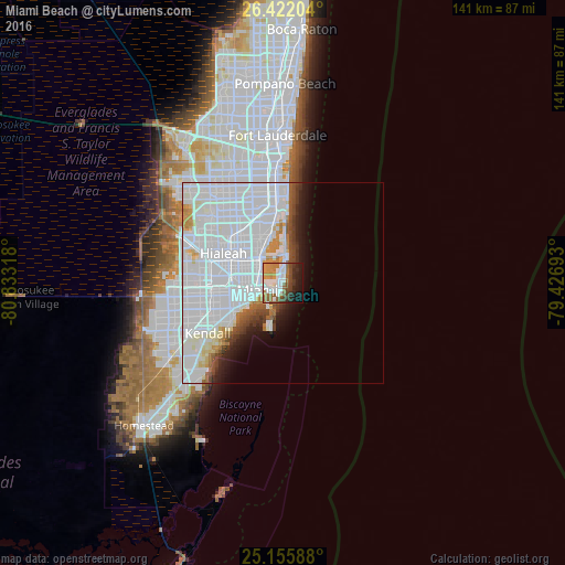
Analysis of Miami Beach night lights 2016
Square area 10x10 km:
 14.2%
14.2%90-99
14.58%80-89
0.19%70-79
13.26%60-69
11.17%50-59
6.63%40-49
9.85%30-39
4.92%20-29
9.09%10-19
14.58%0-9
1.52%Square area 50x50 km:
26.93%90-99
8.14%80-89
1.7%70-79
1.99%60-69
1.78%50-59
1.46%40-49
2.23%30-39
1.57%20-29
2.04%10-19
4%0-9
48.17%Clear (daylight) street map image can be seen on geolist.org.
Map coordinates:
26° 25' 19.3" North, 80° 49' 59.4" West
25° 47' 26.3" North, 80° 7' 48.2" West
25° 9' 21.2" North, 79° 25' 36.9" West
Some cities around Miami Beach sort by population:
• Allapattah
9.8 km =6.1 mi,  285°
285°
• Brownsville
11.6 km =7.2 mi, 287°
• Key Biscayne
11.3 km =7 mi,  196°
196°
• Gladeview
11.9 km =7.4 mi,  297°
297°
• Isle of Normandy
6.9 km =4.3 mi,  355°
355°
• North Bay Village
6.6 km =4.1 mi,  338°
338°
• Bay Harbor Islands
10.8 km =6.7 mi, 359°
• Surfside
9.8 km =6.1 mi,  2°
2°
4164143 (p: 92,312)
Sources (retrieved 2019-11-25):
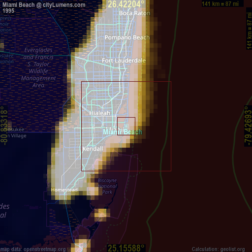
» NASA, Earths city lights 1995
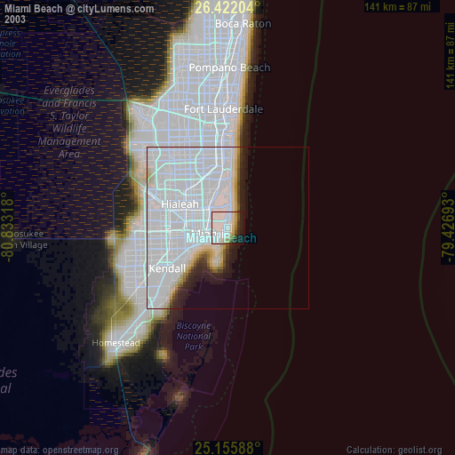
» NASA city lights 2003
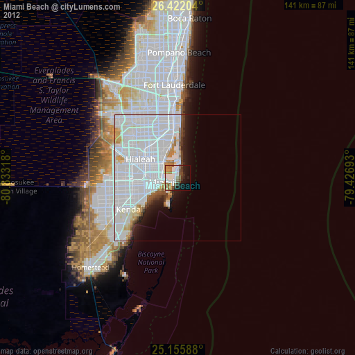
» Earth at Night: Flat Maps 2012, 2016