Allapattah night lights from space
Night Light of Allapattah (Florida) from space (United States) Src. Average luminocity for 10x10km area is 98.8788% and for 50x50km: 58.0012%.
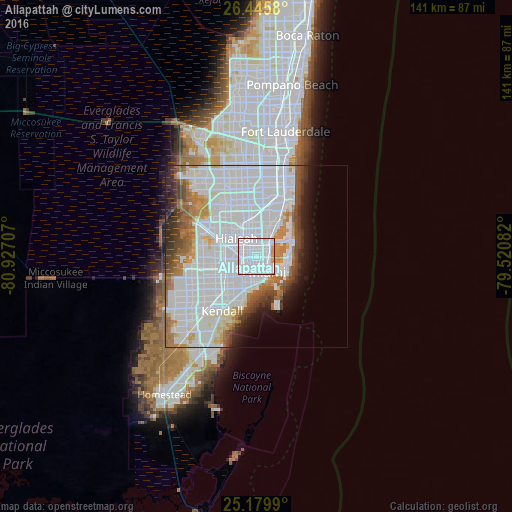
Analysis of Allapattah night lights 2016
Square area 10x10 km:
 85.98%
90-99
9.85%80-89
0.19%70-79
3.98%60-69
0%50-59
0%40-49
0%30-39
0%20-29
0%10-19
0%0-9
0%Square area 50x50 km:
32.76%90-99
11.82%80-89
2.42%70-79
3.13%60-69
4.93%50-59
3.19%40-49
3.73%30-39
3.32%20-29
3.07%10-19
4.14%0-9
27.48%Clear (daylight) street map image can be seen on geolist.org.
Map coordinates:
26° 26' 44.9" North, 80° 55' 37.5" West
25° 48' 52.3" North, 80° 13' 26.2" West
25° 10' 47.6" North, 79° 31' 15" West
Some cities around Allapattah sort by population:
• Miami
5.4 km =3.4 mi,  145°
145°
• Hialeah
7.2 km =4.5 mi,  311°
311°
• West Little River
4.9 km =3 mi,  344°
344°
• Pinewood
6.1 km =3.8 mi,  6°
6°
• Brownsville
1.9 km =1.2 mi,  294°
294°
• Miami Springs
6.6 km =4.1 mi,  277°
277°
• Gladeview
3 km =1.9 mi, 336°
• Miami Shores
6.2 km =3.9 mi,  29°
29°
4145805 (p: 54,289)
Sources (retrieved 2019-11-25):
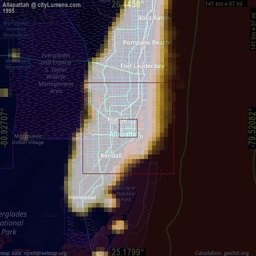
» NASA, Earths city lights 1995
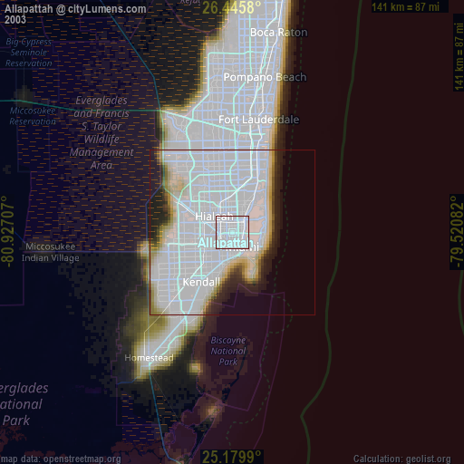
» NASA city lights 2003
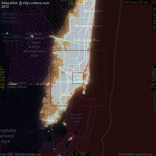
» Earth at Night: Flat Maps 2012, 2016