Surfside night lights from space
Night Light of Surfside (Florida) from space (United States) Src. Average luminocity for 10x10km area is 64.375% and for 50x50km: 49.2014%.
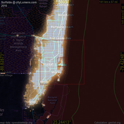
Analysis of Surfside night lights 2016
Square area 10x10 km:
 17.42%
90-99
15.15%80-89
3.79%70-79
14.58%60-69
8.52%50-59
3.6%40-49
10.98%30-39
6.63%20-29
6.82%10-19
12.5%0-9
0%Square area 50x50 km:
30.77%90-99
9.91%80-89
2.32%70-79
2.65%60-69
1.71%50-59
1.6%40-49
2.35%30-39
1.74%20-29
1.8%10-19
3.84%0-9
41.32%Clear (daylight) street map image can be seen on geolist.org.
Map coordinates:
26° 30' 33.6" North, 80° 49' 43.4" West
25° 52' 42.3" North, 80° 7' 32.2" West
25° 14' 38.9" North, 79° 25' 20.9" West
Some cities around Surfside sort by population:
• North Miami
6.2 km =3.9 mi,  281°
281°
• North Miami Beach
7.1 km =4.4 mi,  328°
328°
• Sunny Isles Beach
8 km =5 mi,  1°
1°
• Ojus
8.2 km =5.1 mi,  342°
342°
• Miami Shores
6.9 km =4.3 mi,  255°
255°
• Isle of Normandy
3 km =1.9 mi,  198°
198°
• North Bay Village
4.6 km =2.9 mi,  218°
218°
• Bay Harbor Islands
1.2 km =0.7 mi, 331°
4174518 (p: 6,024)
Sources (retrieved 2019-11-25):
» Earth at Night: Flat Maps 2012, 2016