Merced night lights from space
Night Light of Merced (California) from space (United States) Src. Average luminocity for 10x10km area is 53.7662% and for 50x50km: 7.7351%.
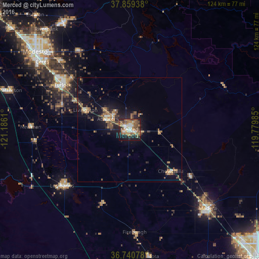

Analysis of Merced night lights 2016
Square area 10x10 km:
 8.93%
8.93%90-99
7.79%80-89
4.06%70-79
9.74%60-69
12.5%50-59
14.61%40-49
8.77%30-39
3.73%20-29
13.31%10-19
15.1%0-9
1.46%Square area 50x50 km:
0.57%90-99
0.62%80-89
0.44%70-79
1.46%60-69
1.63%50-59
1.51%40-49
1.44%30-39
1.37%20-29
1.9%10-19
6.5%0-9
82.56%Clear (daylight) street map image can be seen on geolist.org.
Map coordinates:
37° 51' 33.8" North, 121° 11' 10" West
37° 18' 7.8" North, 120° 28' 58.7" West
36° 44' 26.8" North, 119° 46' 47.5" West
Some cities around Merced sort by population:
• Turlock
38.6 km =24 mi,  303°
303°
• Atwater
12.2 km =7.6 mi,  294°
294°
• Chowchilla
28 km =17.4 mi,  135°
135°
• Livingston
23.3 km =14.5 mi, 293°
• Delhi
29.9 km =18.6 mi, 298°
• Winton
15.1 km =9.4 mi,  310°
310°
• Hilmar-Irwin
34.4 km =21.4 mi, 289°
• Dos Palos
37.4 km =23.2 mi,  199°
199°
5372253 (p: 82,436)
Sources (retrieved 2019-11-25):
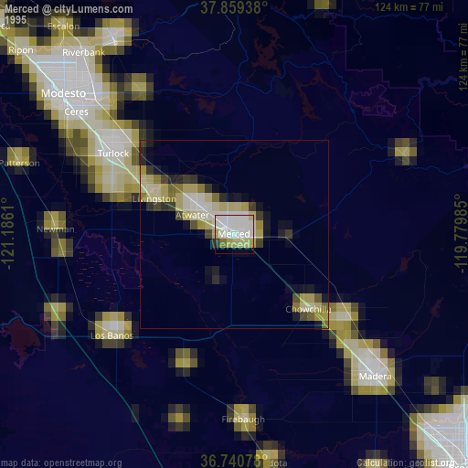
» NASA, Earths city lights 1995
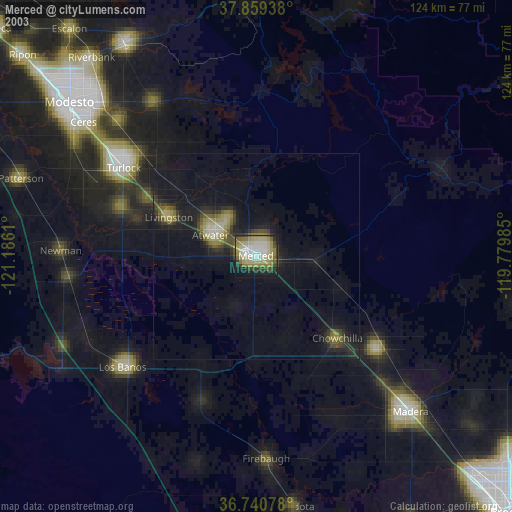
» NASA city lights 2003
» Earth at Night: Flat Maps 2012, 2016