Dos Palos night lights from space
Night Light of Dos Palos (California) from space (United States) Src. Average luminocity for 10x10km area is 5.8101% and for 50x50km: 2.5616%.
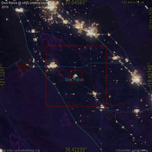
Analysis of Dos Palos night lights 2016
Square area 10x10 km:
 0%
0%90-99
0%80-89
0.65%70-79
2.11%60-69
2.76%50-59
0.32%40-49
0%30-39
1.3%20-29
0.97%10-19
0.32%0-9
91.56%Square area 50x50 km:
0.16%90-99
0.2%80-89
0.16%70-79
0.67%60-69
0.48%50-59
0.37%40-49
0.33%30-39
0.48%20-29
0.33%10-19
1.59%0-9
95.22%Clear (daylight) street map image can be seen on geolist.org.
Map coordinates:
37° 32' 44.3" North, 121° 19' 46.9" West
36° 59' 9.8" North, 120° 37' 35.7" West
36° 25' 20.5" North, 119° 55' 24.4" West
Some cities around Dos Palos sort by population:
• Merced
37.4 km =23.2 mi,  19°
19°
• Los Banos
21.4 km =13.3 mi,  292°
292°
• Atwater
40.2 km =25 mi,  2°
2°
• Chowchilla
35.9 km =22.3 mi,  64°
64°
• Mendota
33.8 km =21 mi,  139°
139°
• Winton
44.9 km =27.9 mi, 1°
• Firebaugh
20.7 km =12.9 mi,  133°
133°
• Gustine
44.7 km =27.8 mi,  312°
312°
5343728 (p: 5,125)
Sources (retrieved 2019-11-25):
» Earth at Night: Flat Maps 2012, 2016