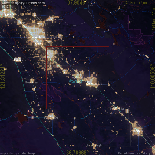
Atwater night lights from space
Night Light of Atwater (California) from space (United States) Src. Average luminocity for 10x10km area is 40.5211% and for 50x50km: 11.1759%.

Analysis of Atwater night lights 2016
Square area 10x10 km:
 3.25%
3.25%90-99
4.55%80-89
2.44%70-79
9.42%60-69
11.36%50-59
6.49%40-49
8.93%30-39
7.47%20-29
9.09%10-19
26.79%0-9
10.23%Square area 50x50 km:
1%90-99
1.27%80-89
0.64%70-79
1.85%60-69
1.89%50-59
1.97%40-49
2.5%30-39
2.53%20-29
3.48%10-19
8.74%0-9
74.14%Clear (daylight) street map image can be seen on geolist.org.
Map coordinates:
37° 54' 16.6" North, 121° 18' 44" West
37° 20' 51.8" North, 120° 36' 32.7" West
36° 47' 12" North, 119° 54' 21.5" West
Some cities around Atwater sort by population:
• Merced
12.2 km =7.6 mi,  114°
114°
• Turlock
26.6 km =16.5 mi,  307°
307°
• Livingston
11 km =6.8 mi,  293°
293°
• Delhi
17.7 km =11 mi,  302°
302°
• Winton
4.6 km =2.9 mi,  355°
355°
• Waterford
35.3 km =21.9 mi,  337°
337°
• Keyes
35.7 km =22.2 mi, 310°
• Hilmar-Irwin
22.2 km =13.8 mi, 286°
5325187 (p: 29,237)
Sources (retrieved 2019-11-25):
» Earth at Night: Flat Maps 2012, 2016