Menifee night lights from space
Night Light of Menifee (California) from space (United States) Src. Average luminocity for 10x10km area is 45.663% and for 50x50km: 34.0083%.
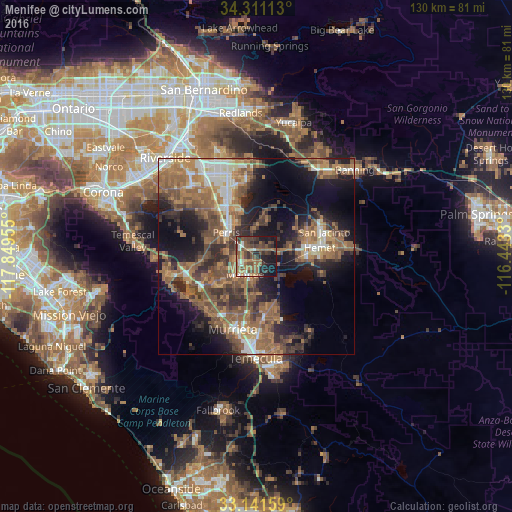

Analysis of Menifee night lights 2016
Square area 10x10 km:
 3.48%
3.48%90-99
4.95%80-89
2.2%70-79
3.66%60-69
13.74%50-59
14.84%40-49
15.75%30-39
10.99%20-29
10.26%10-19
19.41%0-9
0.73%Square area 50x50 km:
3.27%90-99
3.99%80-89
2.23%70-79
4.38%60-69
10.2%50-59
8.84%40-49
8.05%30-39
5.56%20-29
7.78%10-19
15.12%0-9
30.58%Clear (daylight) street map image can be seen on geolist.org.
Map coordinates:
34° 18' 40.1" North, 117° 50' 58.4" West
33° 43' 42.1" North, 117° 8' 47.1" West
33° 8' 29.7" North, 116° 26' 35.9" West
Some cities around Menifee sort by population:
• Hemet
16.2 km =10.1 mi,  82°
82°
• Perris
9.7 km =6 mi,  308°
308°
• Lake Elsinore
18 km =11.2 mi,  248°
248°
• Sun City
5.2 km =3.2 mi, 245°
• Canyon Lake
12.7 km =7.9 mi, 247°
• Good Hope
11.9 km =7.4 mi,  289°
289°
• Nuevo
8.1 km =5 mi,  0°
0°
• Homeland
3.8 km =2.4 mi,  64°
64°
5372205 (p: 87,174)
Sources (retrieved 2019-11-25):
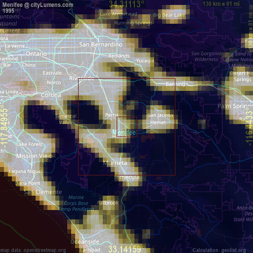
» NASA, Earths city lights 1995
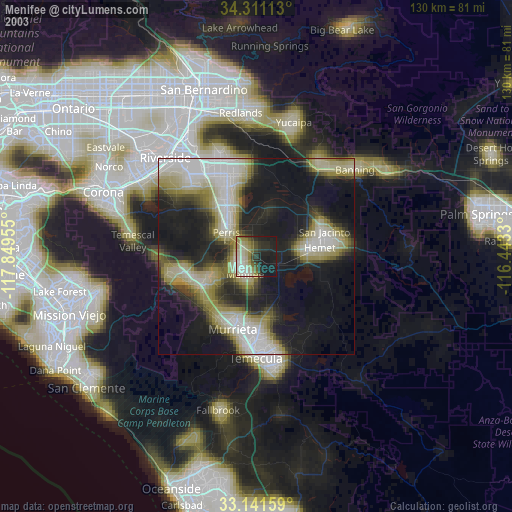
» NASA city lights 2003
» Earth at Night: Flat Maps 2012, 2016