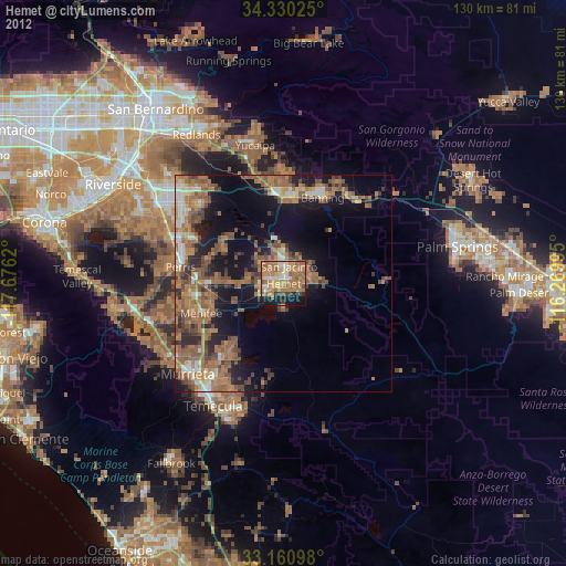
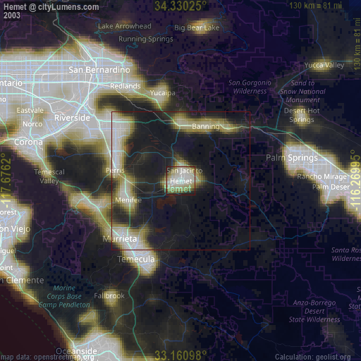
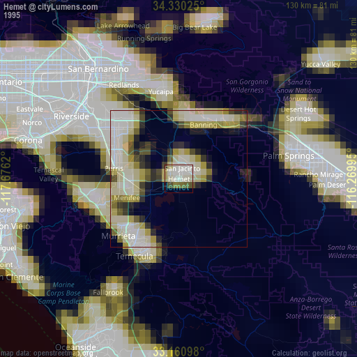
Hemet night lights from space
Night Light of Hemet (California) from space (United States) Src. Average luminocity for 10x10km area is 63.6758% and for 50x50km: 23.0976%.

Analysis of Hemet night lights 2016
Square area 10x10 km:
 6.96%
6.96%90-99
11.36%80-89
9.52%70-79
15.75%60-69
17.22%50-59
12.82%40-49
7.51%30-39
3.11%20-29
10.44%10-19
5.31%0-9
0%Square area 50x50 km:
2.01%90-99
2.53%80-89
1.56%70-79
2.73%60-69
6.47%50-59
6.01%40-49
5.62%30-39
4.37%20-29
5.22%10-19
12.12%0-9
51.36%Clear (daylight) street map image can be seen on geolist.org.
Map coordinates:
34° 19' 48.9" North, 117° 40' 34.3" West
33° 44' 51.4" North, 116° 58' 23.1" West
33° 9' 39.5" North, 116° 16' 11.8" West
Some cities around Hemet sort by population:
• Menifee
16.2 km =10.1 mi,  262°
262°
• San Jacinto
4.3 km =2.7 mi,  18°
18°
• Beaumont
20.2 km =12.6 mi,  358°
358°
• Sun City
21.2 km =13.2 mi, 258°
• East Hemet
3.3 km =2.1 mi,  104°
104°
• Valle Vista
7.4 km =4.6 mi,  89°
89°
• Nuevo
17.1 km =10.6 mi,  290°
290°
• Homeland
12.6 km =7.8 mi,  267°
267°
5356277 (p: 83,861)
Sources (retrieved 2019-11-25):
» NASA, Earths city lights 1995
» NASA city lights 2003
» Earth at Night: Flat Maps 2012, 2016