Marysville night lights from space
Night Light of Marysville (Ohio) from space (United States) Src. Average luminocity for 10x10km area is 38.651% and for 50x50km: 13.4384%.
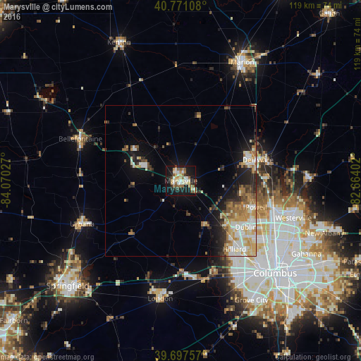
Analysis of Marysville night lights 2016
Square area 10x10 km:
 5.84%
5.84%90-99
7.79%80-89
4.38%70-79
5.03%60-69
5.84%50-59
7.14%40-49
2.44%30-39
2.44%20-29
7.63%10-19
40.91%0-9
10.55%Square area 50x50 km:
2.02%90-99
2.72%80-89
1.62%70-79
2.22%60-69
2.09%50-59
1.56%40-49
1.2%30-39
1.4%20-29
3.08%10-19
6.85%0-9
75.23%Clear (daylight) street map image can be seen on geolist.org.
Map coordinates:
40° 46' 15.9" North, 84° 4' 13" West
40° 14' 11.2" North, 83° 22' 1.7" West
39° 41' 51.3" North, 82° 39' 50.5" West
Some cities around Marysville sort by population:
• Dublin
26.4 km =16.4 mi,  125°
125°
• Delaware
26.3 km =16.3 mi,  74°
74°
• Hilliard
28.7 km =17.8 mi,  141°
141°
• Worthington
33.7 km =20.9 mi,  118°
118°
• Bellefontaine
36.1 km =22.4 mi,  292°
292°
• Powell
26.3 km =16.3 mi,  109°
109°
• Urbana
35.7 km =22.2 mi,  246°
246°
• Lewis Center
30.6 km =19 mi,  97°
97°
5162077 (p: 22,817)
Sources (retrieved 2019-11-25):
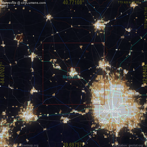
» Earth at Night: Flat Maps 2012, 2016