Delaware night lights from space
Night Light of Delaware (Ohio) from space (United States) Src. Average luminocity for 10x10km area is 49.4745% and for 50x50km: 20.6959%.
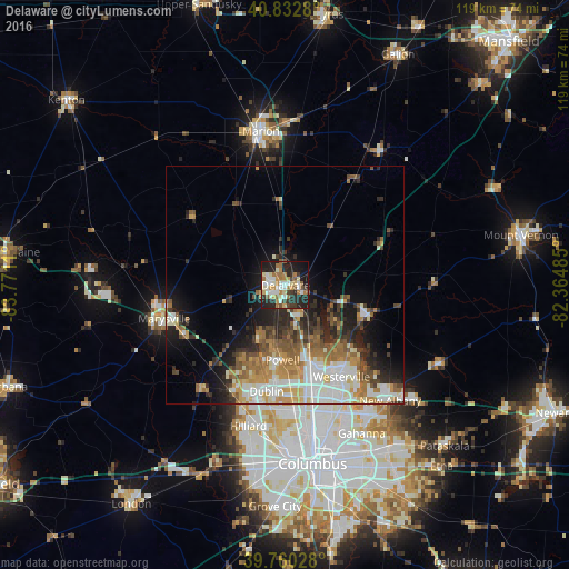
Analysis of Delaware night lights 2016
Square area 10x10 km:
 8.33%
8.33%90-99
10.03%80-89
6.12%70-79
7.31%60-69
10.88%50-59
4.93%40-49
2.89%30-39
5.1%20-29
20.92%10-19
20.41%0-9
3.06%Square area 50x50 km:
3.55%90-99
4.42%80-89
2.03%70-79
2.97%60-69
3.54%50-59
2.88%40-49
2.53%30-39
2.5%20-29
5.27%10-19
7.78%0-9
62.53%Clear (daylight) street map image can be seen on geolist.org.
Map coordinates:
40° 49' 58.1" North, 83° 46' 16" West
40° 17' 55.2" North, 83° 4' 4.7" West
39° 45' 37" North, 82° 21' 53.5" West
Some cities around Delaware sort by population:
• Dublin
22.5 km =14 mi,  190°
190°
• Westerville
22.5 km =14 mi,  148°
148°
• Hilliard
30.5 km =19 mi, 194°
• Marysville
26.3 km =16.3 mi,  254°
254°
• Worthington
23.2 km =14.4 mi,  169°
169°
• Powell
15.7 km =9.8 mi,  182°
182°
• Lewis Center
12.2 km =7.6 mi,  156°
156°
• Sunbury
18.8 km =11.7 mi,  109°
109°
5151891 (p: 37,995)
Sources (retrieved 2019-11-25):
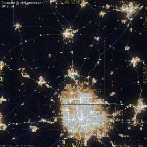
» Earth at Night: Flat Maps 2012, 2016