Bellefontaine night lights from space
Night Light of Bellefontaine (Ohio) from space (United States) Src. Average luminocity for 10x10km area is 21.6531% and for 50x50km: 3.4869%.
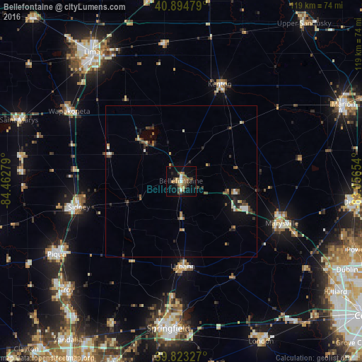
Analysis of Bellefontaine night lights 2016
Square area 10x10 km:
 1.19%
1.19%90-99
1.53%80-89
2.38%70-79
2.89%60-69
5.61%50-59
4.76%40-49
4.93%30-39
2.89%20-29
2.55%10-19
13.95%0-9
57.31%Square area 50x50 km:
0.23%90-99
0.46%80-89
0.3%70-79
0.38%60-69
0.47%50-59
0.63%40-49
0.63%30-39
0.63%20-29
0.78%10-19
1.92%0-9
93.57%Clear (daylight) street map image can be seen on geolist.org.
Map coordinates:
40° 53' 41.2" North, 84° 27' 46" West
40° 21' 40.2" North, 83° 45' 34.8" West
39° 49' 23.8" North, 83° 3' 23.5" West
Some cities around Bellefontaine sort by population:
• Marysville
36.1 km =22.4 mi,  112°
112°
• Sidney
34.6 km =21.5 mi,  255°
255°
• Urbana
28.1 km =17.5 mi,  178°
178°
• Wapakoneta
43.3 km =26.9 mi,  302°
302°
• Kenton
34.2 km =21.3 mi,  21°
21°
• Northridge
41.1 km =25.5 mi, 182°
• Ada
45.7 km =28.4 mi,  353°
353°
• Northwood
12.6 km =7.8 mi,  10°
10°
5146965 (p: 13,117)
Sources (retrieved 2019-11-25):
» Earth at Night: Flat Maps 2012, 2016