Marshall night lights from space
Night Light of Marshall (Missouri) from space (United States) Src. Average luminocity for 10x10km area is 24.3117% and for 50x50km: 1.4533%.
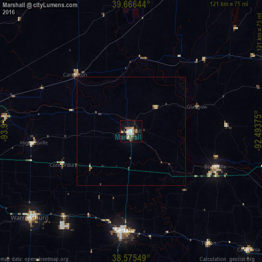
Analysis of Marshall night lights 2016
Square area 10x10 km:
 3.57%
3.57%90-99
3.9%80-89
1.62%70-79
3.41%60-69
5.68%50-59
2.6%40-49
3.9%30-39
1.95%20-29
0%10-19
24.51%0-9
48.86%Square area 50x50 km:
0.15%90-99
0.19%80-89
0.12%70-79
0.17%60-69
0.31%50-59
0.16%40-49
0.32%30-39
0.25%20-29
0.06%10-19
1.08%0-9
97.2%Clear (daylight) street map image can be seen on geolist.org.
Map coordinates:
39° 39' 59.2" North, 93° 54' 0" West
39° 7' 23.1" North, 93° 11' 48.7" West
38° 34' 31.8" North, 92° 29' 37.5" West
Some cities around Marshall sort by population:
• Columbia
76.9 km =47.8 mi,  104°
104°
• Sedalia
46.6 km =29 mi,  183°
183°
• Warrensburg
61.5 km =38.2 mi,  229°
229°
• Moberly
73.1 km =45.4 mi,  63°
63°
• Chillicothe
80.7 km =50.1 mi,  337°
337°
• Boonville
42.6 km =26.5 mi,  112°
112°
• Richmond
69.4 km =43.1 mi,  284°
284°
• Odessa
66.8 km =41.5 mi,  258°
258°
4397211 (p: 13,039)
Sources (retrieved 2019-11-25):
» Earth at Night: Flat Maps 2012, 2016