Natchez night lights from space
Night Light of Natchez (Mississippi) from space (United States) Src. Average luminocity for 10x10km area is 56.4441% and for 50x50km: 5.2428%.
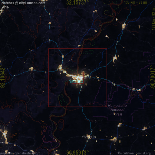
Analysis of Natchez night lights 2016
Square area 10x10 km:
 11.71%
90-99
11.19%80-89
8.22%70-79
9.27%60-69
10.14%50-59
2.62%40-49
7.34%30-39
4.72%20-29
20.28%10-19
14.51%0-9
0%Square area 50x50 km:
0.54%90-99
0.6%80-89
0.72%70-79
0.84%60-69
0.89%50-59
0.38%40-49
0.76%30-39
0.81%20-29
1.4%10-19
4.5%0-9
88.56%Clear (daylight) street map image can be seen on geolist.org.
Map coordinates:
32° 9' 26.5" North, 92° 6' 23.1" West
31° 33' 36.6" North, 91° 24' 11.8" West
30° 57' 32.9" North, 90° 42' 0.6" West
Some cities around Natchez sort by population:
• Alexandria
102.6 km =63.8 mi,  254°
254°
• Vicksburg
101.1 km =62.8 mi,  29°
29°
• Zachary
104.1 km =64.7 mi,  166°
166°
• Pineville
101.3 km =62.9 mi, 254°
• McComb
96.8 km =60.1 mi,  111°
111°
• Brookhaven
91.2 km =56.7 mi,  88°
88°
• Tallulah
96.5 km =60 mi,  12°
12°
• Marksville
79.2 km =49.2 mi,  232°
232°
4437982 (p: 15,128)
Sources (retrieved 2019-11-25):
» Earth at Night: Flat Maps 2012, 2016