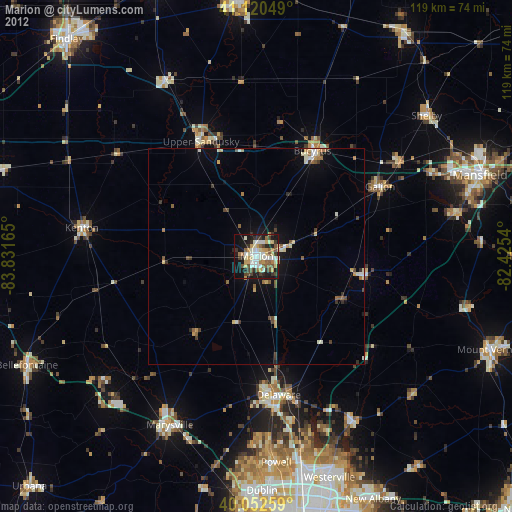
Marion night lights from space
Night Light of Marion (Ohio) from space (United States) Src. Average luminocity for 10x10km area is 48.5828% and for 50x50km: 4.4982%.
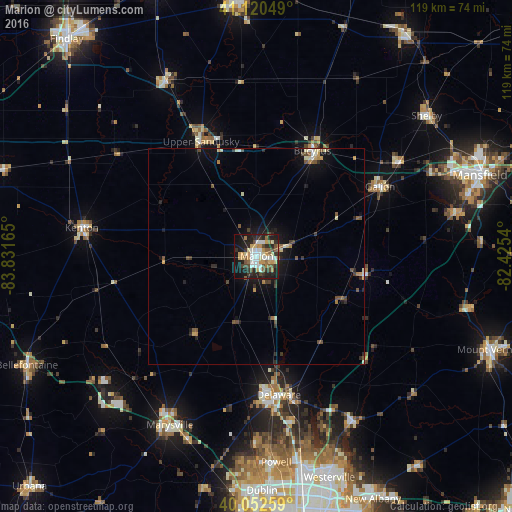
Analysis of Marion night lights 2016
Square area 10x10 km:
 8.28%
8.28%90-99
10.06%80-89
5.36%70-79
10.06%60-69
3.41%50-59
7.14%40-49
6.82%30-39
6.17%20-29
15.26%10-19
22.56%0-9
4.87%Square area 50x50 km:
0.4%90-99
0.67%80-89
0.48%70-79
0.68%60-69
0.38%50-59
0.72%40-49
0.78%30-39
0.61%20-29
1.21%10-19
3.2%0-9
90.86%Clear (daylight) street map image can be seen on geolist.org.
Map coordinates:
41° 7' 13.8" North, 83° 49' 53.9" West
40° 35' 19.2" North, 83° 7' 42.7" West
40° 3' 9.3" North, 82° 25' 31.4" West
Some cities around Marion sort by population:
• Delaware
32.6 km =20.3 mi,  170°
170°
• Marysville
44.1 km =27.4 mi,  207°
207°
• Bucyrus
27.6 km =17.1 mi,  27°
27°
• Lewis Center
44.5 km =27.7 mi, 166°
• Galion
32.8 km =20.4 mi,  60°
60°
• Kenton
41.1 km =25.5 mi,  279°
279°
• Upper Sandusky
29.5 km =18.3 mi,  334°
334°
• Sunbury
44.7 km =27.8 mi,  149°
149°
5161902 (p: 36,363)
Sources (retrieved 2019-11-25):
» Earth at Night: Flat Maps 2012, 2016