Kenton night lights from space
Night Light of Kenton (Ohio) from space (United States) Src. Average luminocity for 10x10km area is 17.3263% and for 50x50km: 1.8617%.
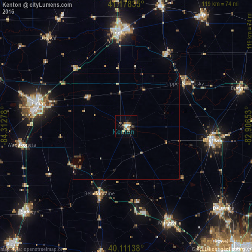
Analysis of Kenton night lights 2016
Square area 10x10 km:
 1.95%
1.95%90-99
1.95%80-89
2.92%70-79
1.14%60-69
3.73%50-59
3.08%40-49
1.95%30-39
1.3%20-29
2.76%10-19
7.63%0-9
71.59%Square area 50x50 km:
0.12%90-99
0.25%80-89
0.22%70-79
0.23%60-69
0.32%50-59
0.32%40-49
0.18%30-39
0.25%20-29
0.53%10-19
0.47%0-9
97.12%Clear (daylight) street map image can be seen on geolist.org.
Map coordinates:
41° 10' 42.1" North, 84° 18' 46" West
40° 38' 49.2" North, 83° 36' 34.7" West
40° 6' 41" North, 82° 54' 23.5" West
Some cities around Kenton sort by population:
• Findlay
44.3 km =27.5 mi,  355°
355°
• Lima
43.1 km =26.8 mi,  284°
284°
• Marion
41.1 km =25.5 mi,  99°
99°
• Marysville
50 km =31.1 mi,  155°
155°
• Bellefontaine
34.2 km =21.3 mi,  201°
201°
• Upper Sandusky
34.2 km =21.3 mi,  54°
54°
• Ada
22.5 km =14 mi,  307°
307°
• Northwood
22 km =13.7 mi,  208°
208°
5159554 (p: 8,211)
Sources (retrieved 2019-11-25):
» Earth at Night: Flat Maps 2012, 2016