Bucyrus night lights from space
Night Light of Bucyrus (Ohio) from space (United States) Src. Average luminocity for 10x10km area is 24.2041% and for 50x50km: 4.8159%.
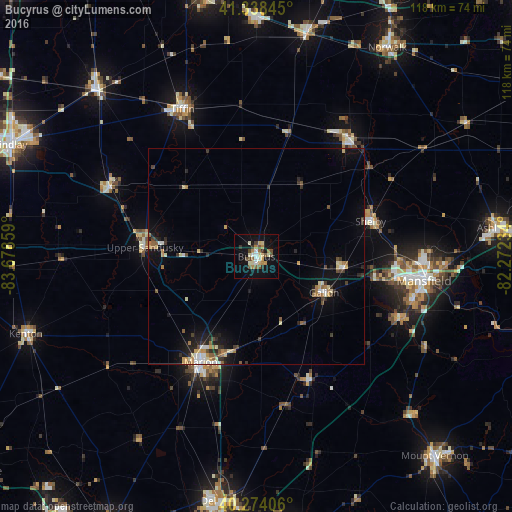
Analysis of Bucyrus night lights 2016
Square area 10x10 km:
 1.7%
1.7%90-99
4.76%80-89
4.08%70-79
2.55%60-69
3.57%50-59
3.06%40-49
4.76%30-39
2.55%20-29
0.85%10-19
21.6%0-9
50.51%Square area 50x50 km:
0.37%90-99
0.65%80-89
0.73%70-79
0.53%60-69
0.62%50-59
0.61%40-49
0.53%30-39
0.8%20-29
0.9%10-19
3.38%0-9
90.88%Clear (daylight) street map image can be seen on geolist.org.
Map coordinates:
41° 20' 18.4" North, 83° 40' 42.9" West
40° 48' 30.2" North, 82° 58' 31.7" West
40° 16' 26.6" North, 82° 16' 20.4" West
Some cities around Bucyrus sort by population:
• Mansfield
39.1 km =24.3 mi,  98°
98°
• Marion
27.6 km =17.1 mi,  207°
207°
• Tiffin
38 km =23.6 mi,  333°
333°
• Galion
17.7 km =11 mi,  117°
117°
• Shelby
27.6 km =17.1 mi,  72°
72°
• Upper Sandusky
25.8 km =16 mi,  274°
274°
• Ontario
32.9 km =20.4 mi, 99°
• Willard
34.3 km =21.3 mi,  37°
37°
5148635 (p: 11,916)
Sources (retrieved 2019-11-25):
» Earth at Night: Flat Maps 2012, 2016