Mariners Harbor night lights from space
Night Light of Mariners Harbor (New York) from space (United States) Src. Average luminocity for 10x10km area is 97.5325% and for 50x50km: 76.2899%.
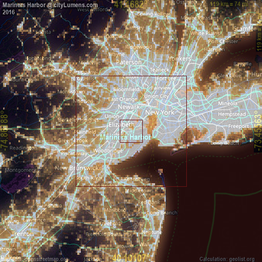
Analysis of Mariners Harbor night lights 2016
Square area 10x10 km:
 70.94%
90-99
19.16%80-89
5.52%70-79
4.38%60-69
0%50-59
0%40-49
0%30-39
0%20-29
0%10-19
0%0-9
0%Square area 50x50 km:
37.01%90-99
18.39%80-89
7.82%70-79
8.46%60-69
6.28%50-59
2.6%40-49
1.58%30-39
2.24%20-29
3.1%10-19
3.65%0-9
8.87%Clear (daylight) street map image can be seen on geolist.org.
Map coordinates:
41° 10' 5.5" North, 74° 51' 42.8" West
40° 38' 12.4" North, 74° 9' 31.5" West
40° 6' 3.9" North, 73° 27' 20.3" West
Some cities around Mariners Harbor sort by population:
• Elizabeth
5.3 km =3.3 mi,  304°
304°
• Bayonne
5.2 km =3.2 mi,  46°
46°
• New Springville
4.8 km =3 mi,  184°
184°
• Port Richmond
1.9 km =1.2 mi,  102°
102°
• Emerson Hill
6.1 km =3.8 mi,  120°
120°
• Graniteville
1.6 km =1 mi,  146°
146°
• Westerleigh
2.9 km =1.8 mi,  127°
127°
• Tompkinsville
6.8 km =4.2 mi,  88°
88°
5126013 (p: 19,905)
Sources (retrieved 2019-11-25):
» Earth at Night: Flat Maps 2012, 2016