Graniteville night lights from space
Night Light of Graniteville (New York) from space (United States) Src. Average luminocity for 10x10km area is 96.8328% and for 50x50km: 75.1989%.
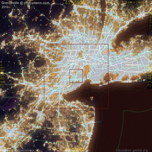
Analysis of Graniteville night lights 2016
Square area 10x10 km:
 64.77%
90-99
22.73%80-89
5.84%70-79
6.66%60-69
0%50-59
0%40-49
0%30-39
0%20-29
0%10-19
0%0-9
0%Square area 50x50 km:
36.38%90-99
18.04%80-89
7.66%70-79
8.18%60-69
6.47%50-59
2.64%40-49
1.75%30-39
2.23%20-29
3.01%10-19
3.78%0-9
9.87%Clear (daylight) street map image can be seen on geolist.org.
Map coordinates:
41° 9' 22.9" North, 74° 51' 5.8" West
40° 37' 29.4" North, 74° 8' 54.5" West
40° 5' 20.5" North, 73° 26' 43.3" West
Some cities around Graniteville sort by population:
• Bayonne
5.7 km =3.5 mi,  30°
30°
• New Springville
3.7 km =2.3 mi,  199°
199°
• Mariners Harbor
1.6 km =1 mi,  326°
326°
• Port Richmond
1.4 km =0.9 mi,  47°
47°
• Emerson Hill
4.8 km =3 mi,  112°
112°
• Westerleigh
1.5 km =0.9 mi, 105°
• Concord
5.7 km =3.5 mi, 108°
• Stapleton
6 km =3.7 mi,  88°
88°
5119049 (p: 15,272)
Sources (retrieved 2019-11-25):
» Earth at Night: Flat Maps 2012, 2016