Manchester night lights from space
Night Light of Manchester (New Hampshire) from space (United States) Src. Average luminocity for 10x10km area is 67.319% and for 50x50km: 15.4919%.
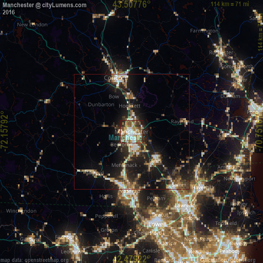

Analysis of Manchester night lights 2016
Square area 10x10 km:
 15.56%
90-99
15.4%80-89
6.83%70-79
9.05%60-69
10.95%50-59
15.71%40-49
10%30-39
5.56%20-29
8.41%10-19
2.54%0-9
0%Square area 50x50 km:
1.74%90-99
2.41%80-89
1.63%70-79
1.73%60-69
1.94%50-59
2.24%40-49
2.84%30-39
2.77%20-29
5.54%10-19
13.19%0-9
63.98%Clear (daylight) street map image can be seen on geolist.org.
Map coordinates:
43° 30' 27.9" North, 72° 9' 28.5" West
42° 59' 44.3" North, 71° 27' 17.2" West
42° 28' 45.2" North, 70° 45' 6" West
Some cities around Manchester sort by population:
• Derry Village
16.4 km =10.2 mi,  134°
134°
• Merrimack
14.9 km =9.3 mi,  192°
192°
• Bedford
7.4 km =4.6 mi,  222°
222°
• Londonderry
15.9 km =9.9 mi,  155°
155°
• Bow Bog
14.6 km =9.1 mi,  341°
341°
• South Hooksett
3.8 km =2.4 mi,  24°
24°
• Suncook
15 km =9.3 mi,  0°
0°
• Auburn
8.7 km =5.4 mi,  83°
83°
5089178 (p: 110,229)
Sources (retrieved 2019-11-25):
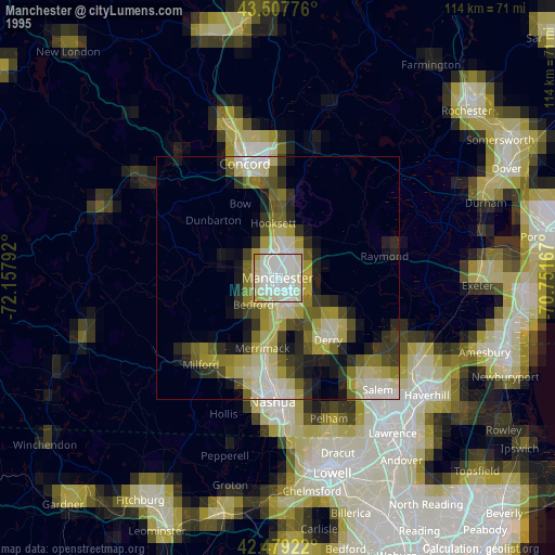
» NASA, Earths city lights 1995
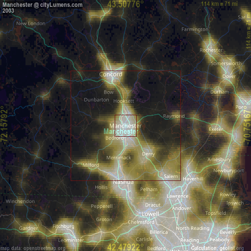
» NASA city lights 2003
» Earth at Night: Flat Maps 2012, 2016