Suncook night lights from space
Night Light of Suncook (New Hampshire) from space (United States) Src. Average luminocity for 10x10km area is 18.4939% and for 50x50km: 9.5687%.
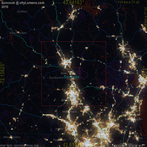
Analysis of Suncook night lights 2016
Square area 10x10 km:
 1.06%
1.06%90-99
1.36%80-89
0.91%70-79
0.61%60-69
4.24%50-59
2.42%40-49
5.45%30-39
4.24%20-29
3.79%10-19
32.58%0-9
43.33%Square area 50x50 km:
1.34%90-99
1.56%80-89
0.91%70-79
0.99%60-69
1.2%50-59
1.39%40-49
1.76%30-39
1.48%20-29
3.1%10-19
7%0-9
79.25%Clear (daylight) street map image can be seen on geolist.org.
Map coordinates:
43° 38' 29.9" North, 72° 9' 22.5" West
43° 7' 50.3" North, 71° 27' 11.2" West
42° 36' 55.3" North, 70° 45' 0" West
Some cities around Suncook sort by population:
• Manchester
15 km =9.3 mi,  180°
180°
• Concord
11 km =6.8 mi,  321°
321°
• East Concord
14.2 km =8.8 mi,  330°
330°
• Bow Bog
4.9 km =3 mi,  256°
256°
• Pembroke
1.8 km =1.1 mi,  348°
348°
• Hopkinton
19.3 km =12 mi,  290°
290°
• South Hooksett
11.7 km =7.3 mi,  172°
172°
• Auburn
16.4 km =10.2 mi,  148°
148°
5093360 (p: 5,379)
Sources (retrieved 2019-11-25):
» Earth at Night: Flat Maps 2012, 2016