Malden night lights from space
Night Light of Malden (Massachusetts) from space (United States) Src. Average luminocity for 10x10km area is 94.0032% and for 50x50km: 53.695%.
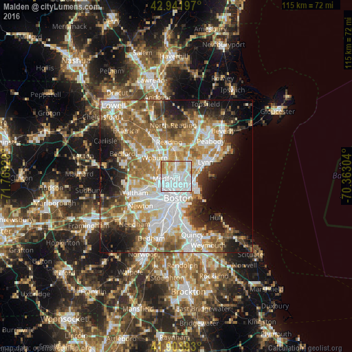

Analysis of Malden night lights 2016
Square area 10x10 km:
 48.89%
90-99
27.46%80-89
10.95%70-79
9.05%60-69
3.65%50-59
0%40-49
0%30-39
0%20-29
0%10-19
0%0-9
0%Square area 50x50 km:
13.48%90-99
11.4%80-89
6.15%70-79
7.41%60-69
9.49%50-59
8.59%40-49
5.38%30-39
4.84%20-29
7.52%10-19
9.8%0-9
15.95%Clear (daylight) street map image can be seen on geolist.org.
Map coordinates:
42° 56' 31.1" North, 71° 46' 9.4" West
42° 25' 30.4" North, 71° 3' 58.2" West
41° 54' 14.1" North, 70° 21' 46.9" West
Some cities around Malden sort by population:
• Cambridge
6.4 km =4 mi,  210°
210°
• Somerville
5 km =3.1 mi, 213°
• Medford
3.4 km =2.1 mi,  257°
257°
• Revere
4.8 km =3 mi,  112°
112°
• Everett
2.1 km =1.3 mi,  151°
151°
• Chelsea
4.6 km =2.9 mi,  143°
143°
• Melrose
3.7 km =2.3 mi,  0°
0°
• Saugus
6.4 km =4 mi,  46°
46°
4942939 (p: 61,068)
Sources (retrieved 2019-11-25):
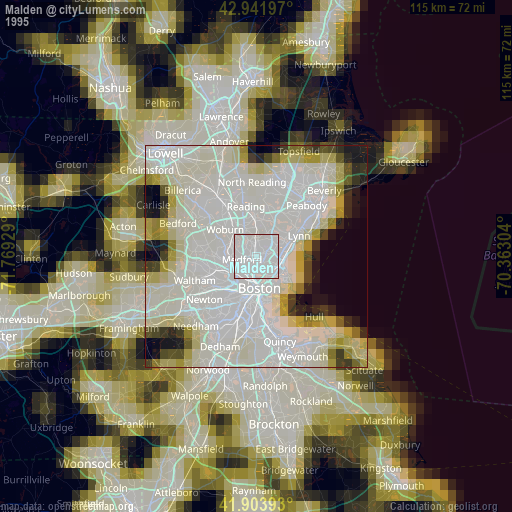
» NASA, Earths city lights 1995
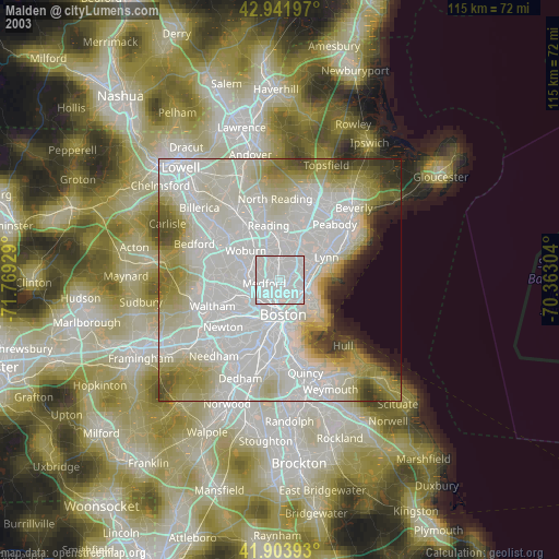
» NASA city lights 2003
» Earth at Night: Flat Maps 2012, 2016