Madisonville night lights from space
Night Light of Madisonville (Kentucky) from space (United States) Src. Average luminocity for 10x10km area is 53.5828% and for 50x50km: 6.4891%.
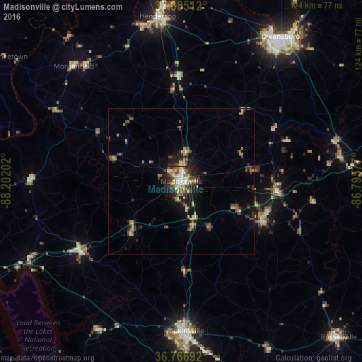
Analysis of Madisonville night lights 2016
Square area 10x10 km:
 7.31%
7.31%90-99
11.04%80-89
9.42%70-79
6.33%60-69
7.47%50-59
8.77%40-49
9.9%30-39
8.93%20-29
15.91%10-19
14.77%0-9
0.16%Square area 50x50 km:
0.31%90-99
0.71%80-89
1.1%70-79
0.72%60-69
0.94%50-59
1.19%40-49
1.01%30-39
1.4%20-29
1.89%10-19
4.26%0-9
86.46%Clear (daylight) street map image can be seen on geolist.org.
Map coordinates:
37° 53' 6.4" North, 88° 12' 7.3" West
37° 19' 41.2" North, 87° 29' 56" West
36° 46' 0.9" North, 86° 47' 44.8" West
Some cities around Madisonville sort by population:
• Owensboro
60.1 km =37.3 mi,  34°
34°
• Hopkinsville
51.4 km =31.9 mi,  179°
179°
• Henderson
57.1 km =35.5 mi,  351°
351°
• Oak Grove
65.8 km =40.9 mi,  88°
88°
• Morehead
29.2 km =18.1 mi,  102°
102°
• Knottsville
72 km =44.7 mi,  46°
46°
• Princeton
41.7 km =25.9 mi,  234°
234°
• Central City
33.4 km =20.8 mi, 96°
4299670 (p: 19,539)
Sources (retrieved 2019-11-25):
» Earth at Night: Flat Maps 2012, 2016