Livingston night lights from space
Night Light of Livingston (Montana) from space (United States) Src. Average luminocity for 10x10km area is 7.6561% and for 50x50km: 0.3107%.
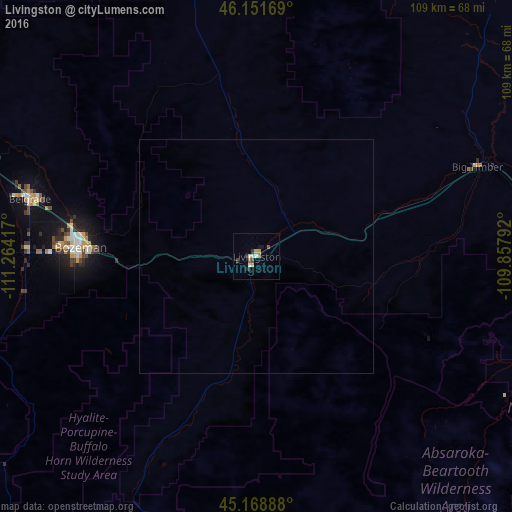
Analysis of Livingston night lights 2016
Square area 10x10 km:
 0.91%
0.91%90-99
1.06%80-89
1.36%70-79
0.91%60-69
1.21%50-59
0.61%40-49
0.61%30-39
1.82%20-29
0.76%10-19
1.67%0-9
89.09%Square area 50x50 km:
0.04%90-99
0.04%80-89
0.05%70-79
0.04%60-69
0.05%50-59
0.02%40-49
0.02%30-39
0.07%20-29
0.03%10-19
0.07%0-9
99.57%Clear (daylight) street map image can be seen on geolist.org.
Map coordinates:
46° 9' 6.1" North, 111° 15' 51" West
45° 39' 44.8" North, 110° 33' 39.7" West
45° 10' 8" North, 109° 51' 28.5" West
Some cities around Livingston sort by population:
• Billings
160.5 km =99.7 mi,  85°
85°
• Bozeman
37.2 km =23.1 mi,  272°
272°
• Butte
157.5 km =97.9 mi,  283°
283°
• Helena
153.7 km =95.5 mi,  312°
312°
• Helena Valley Southeast
149 km =92.6 mi,  315°
315°
• Belgrade
49.4 km =30.7 mi, 284°
• Helena Valley West Central
160.3 km =99.6 mi, 313°
• Laurel
139.1 km =86.4 mi, 89°
5663049 (p: 7,302)
Sources (retrieved 2019-11-25):
» Earth at Night: Flat Maps 2012, 2016