Livermore night lights from space
Night Light of Livermore (California) from space (United States) Src. Average luminocity for 10x10km area is 57.6378% and for 50x50km: 20.9622%.
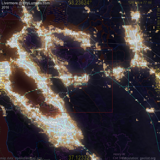
Analysis of Livermore night lights 2016
Square area 10x10 km:
 10.88%
90-99
10.03%80-89
1.87%70-79
11.05%60-69
10.54%50-59
15.48%40-49
12.07%30-39
3.06%20-29
18.88%10-19
5.95%0-9
0.17%Square area 50x50 km:
3%90-99
2.83%80-89
1.13%70-79
3%60-69
3.42%50-59
4.61%40-49
3.99%30-39
2.94%20-29
6.86%10-19
13.95%0-9
54.27%Clear (daylight) street map image can be seen on geolist.org.
Map coordinates:
38° 14' 10.5" North, 122° 28' 16.1" West
37° 40' 54.7" North, 121° 46' 4.8" West
37° 7' 24" North, 121° 3' 53.6" West
Some cities around Livermore sort by population:
• Fremont
24.5 km =15.2 mi,  232°
232°
• Pleasanton
9.6 km =6 mi,  257°
257°
• San Ramon
21.4 km =13.3 mi,  300°
300°
• Union City
24.1 km =15 mi,  246°
246°
• Dublin
14.9 km =9.3 mi,  278°
278°
• Fairview
24.4 km =15.2 mi,  269°
269°
• Mountain House
22.8 km =14.2 mi,  60°
60°
• Blackhawk
19.7 km =12.2 mi,  321°
321°
5367440 (p: 88,126)
Sources (retrieved 2019-11-25):
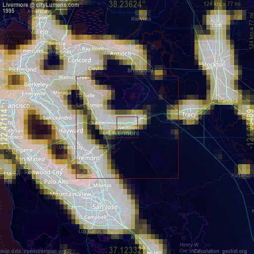
» NASA, Earths city lights 1995
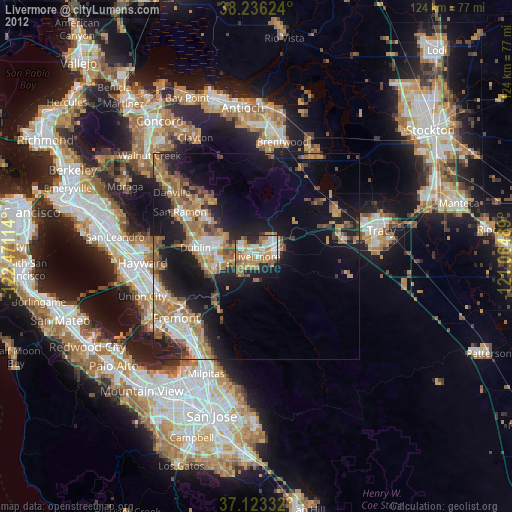
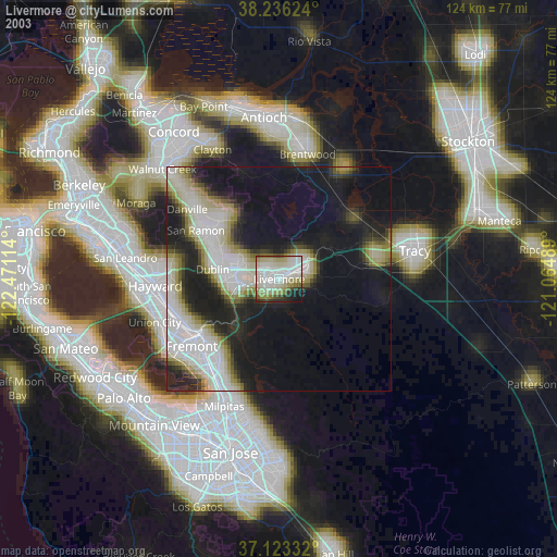
» NASA city lights 2003
» Earth at Night: Flat Maps 2012, 2016