Little Chute night lights from space
Night Light of Little Chute (Wisconsin) from space (United States) Src. Average luminocity for 10x10km area is 71.8636% and for 50x50km: 18.6904%.
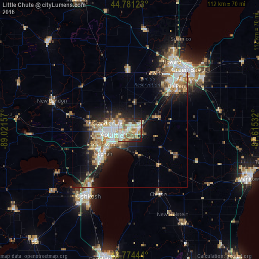
Analysis of Little Chute night lights 2016
Square area 10x10 km:
 18.94%
90-99
18.94%80-89
9.85%70-79
10%60-69
10.3%50-59
10.15%40-49
4.85%30-39
4.39%20-29
10.15%10-19
2.42%0-9
0%Square area 50x50 km:
3.28%90-99
3.65%80-89
2.36%70-79
2.54%60-69
2.67%50-59
2.52%40-49
1.76%30-39
2.02%20-29
5.03%10-19
8.83%0-9
65.35%Clear (daylight) street map image can be seen on geolist.org.
Map coordinates:
44° 46' 52.4" North, 89° 1' 17.7" West
44° 16' 48" North, 88° 19' 6.4" West
43° 46' 28" North, 87° 36' 55.2" West
Some cities around Little Chute sort by population:
• Appleton
8 km =5 mi,  255°
255°
• Neenah
15.5 km =9.6 mi,  227°
227°
• De Pere
27.8 km =17.3 mi,  47°
47°
• Menasha
13.4 km =8.3 mi, 229°
• Kaukauna
3.7 km =2.3 mi,  93°
93°
• Hobart
27.8 km =17.3 mi,  28°
28°
• Harrison
6 km =3.7 mi,  193°
193°
• Kimberly
1.9 km =1.2 mi,  242°
242°
5260262 (p: 11,026)
Sources (retrieved 2019-11-25):
» Earth at Night: Flat Maps 2012, 2016