Kimberly night lights from space
Night Light of Kimberly (Wisconsin) from space (United States) Src. Average luminocity for 10x10km area is 76.1333% and for 50x50km: 18.2283%.
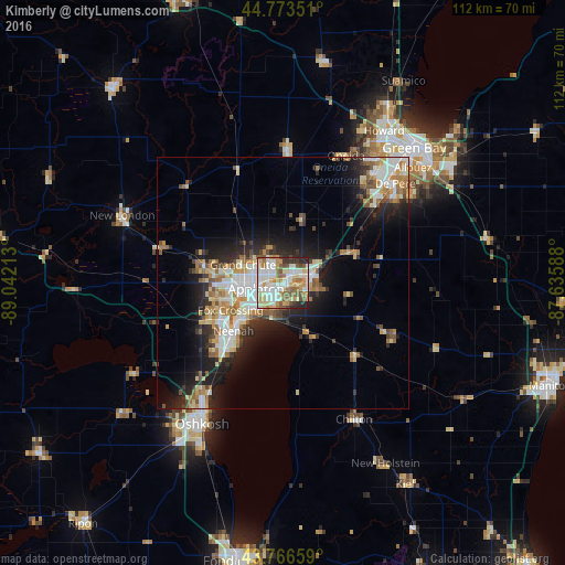
Analysis of Kimberly night lights 2016
Square area 10x10 km:
 21.06%
90-99
20.61%80-89
11.36%70-79
11.06%60-69
10.3%50-59
10%40-49
4.39%30-39
4.09%20-29
6.97%10-19
0.15%0-9
0%Square area 50x50 km:
3.19%90-99
3.58%80-89
2.3%70-79
2.41%60-69
2.54%50-59
2.4%40-49
1.76%30-39
1.95%20-29
5.08%10-19
8.74%0-9
66.05%Clear (daylight) street map image can be seen on geolist.org.
Map coordinates:
44° 46' 24.6" North, 89° 2' 31.7" West
44° 16' 20" North, 88° 20' 20.4" West
43° 45' 59.7" North, 87° 38' 9.2" West
Some cities around Kimberly sort by population:
• Appleton
6.2 km =3.9 mi,  259°
259°
• Neenah
13.8 km =8.6 mi,  225°
225°
• De Pere
29.6 km =18.4 mi,  48°
48°
• Menasha
11.6 km =7.2 mi, 227°
• Kaukauna
5.4 km =3.4 mi,  83°
83°
• Little Chute
1.9 km =1.2 mi,  62°
62°
• Hobart
29.4 km =18.3 mi,  30°
30°
• Harrison
4.9 km =3 mi,  177°
177°
5258575 (p: 6,744)
Sources (retrieved 2019-11-25):
» Earth at Night: Flat Maps 2012, 2016