Lithia Springs night lights from space
Night Light of Lithia Springs (Georgia) from space (United States) Src. Average luminocity for 10x10km area is 77.6941% and for 50x50km: 67.786%.
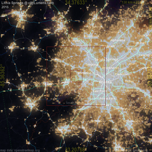
Analysis of Lithia Springs night lights 2016
Square area 10x10 km:
 10.31%
90-99
15.73%80-89
12.06%70-79
24.83%60-69
31.29%50-59
4.37%40-49
1.4%30-39
0%20-29
0%10-19
0%0-9
0%Square area 50x50 km:
16.64%90-99
14.48%80-89
12.55%70-79
14.47%60-69
11.99%50-59
5.73%40-49
2.97%30-39
3.76%20-29
4.84%10-19
5.53%0-9
7.03%Clear (daylight) street map image can be seen on geolist.org.
Map coordinates:
34° 22' 34.8" North, 85° 21' 49" West
33° 47' 38.4" North, 84° 39' 37.8" West
33° 12' 27.6" North, 83° 57' 26.5" West
Some cities around Lithia Springs sort by population:
• Marietta
20.4 km =12.7 mi,  30°
30°
• Smyrna
16.8 km =10.4 mi,  53°
53°
• Mableton
7.7 km =4.8 mi,  69°
69°
• Douglasville
9.3 km =5.8 mi,  239°
239°
• Powder Springs
7.6 km =4.7 mi,  343°
343°
• Vinings
19.8 km =12.3 mi, 66°
• Fair Oaks
17.3 km =10.7 mi,  38°
38°
• Austell
3.2 km =2 mi, 49°
4205885 (p: 15,491)
Sources (retrieved 2019-11-25):
» Earth at Night: Flat Maps 2012, 2016